S.S. Thomas T. Tucker, a US Liberty ship operated by the Merchants and Miners Company on behalf of the US Maritime Commission, was part of the 42-ship convoy carrying material to the African Front during World War II. The ship was reported lost in action, torpedoed at Cape Point. The cargo included 25 Sherman tanks, 16 tank cars, 200 motor vehicles, and barbed wire. This disarticulated beach shipwreck site provides an ideal educational opportunity for students to conduct basic pre-disturbance archaeological recording, geo-referencing, and digital mapping.
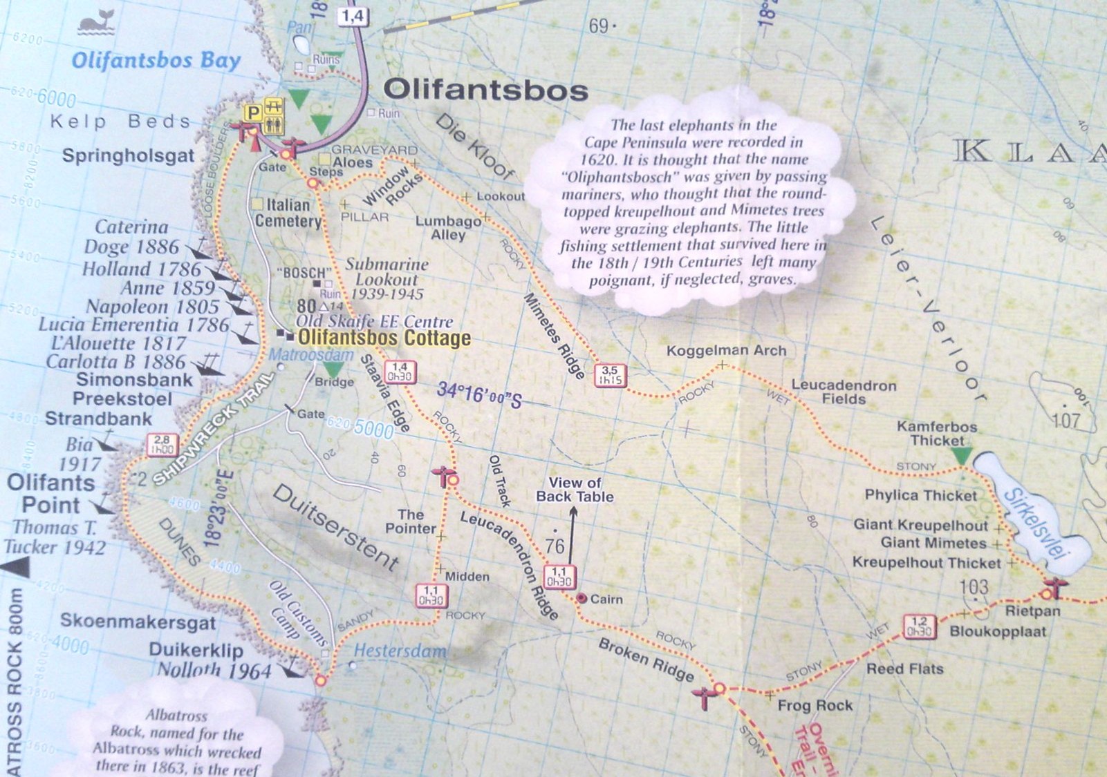
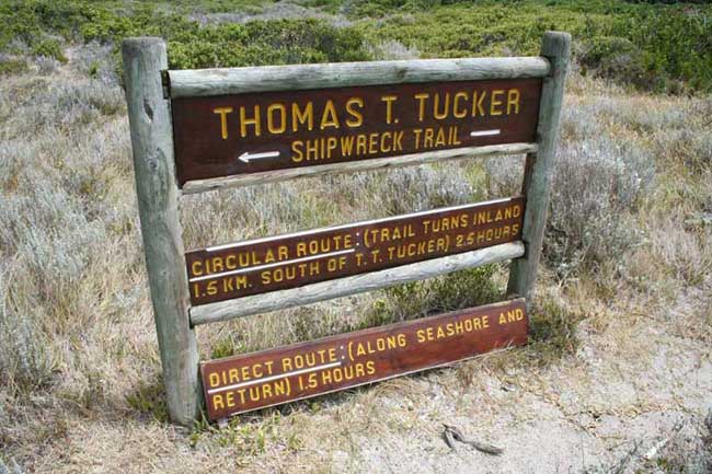
During East Carolina University’s (ECU) Summer Study Abroad Program 2014, several students and faculty participated in a study of the maritime cultural landscape in False Bay, Cape Peninsula, South Africa. Part of this study was to investigate the wreckage of S.S. Thomas T. Tucker (1942), an American Liberty Ship that ran aground near the coastal area known as Olifantsbos Point. ECU students in a previous study undertook examination of this site abroad in 2012. A GPS map of the major pieces of wreckage and measurements of the pieces was completed at that time. The intent of this survey was to record the locations and level of degradation of the remaining wreckage and to examine South Africa’s importance to the American war effort.
S.S. Thomas T. Tucker was constructed at the Houston Shipbuilding Corporation in Houston, Texas. The vessel’s keel was laid on June 16, 1942, and the vessel launched on August 31, 1942, at a length of 422.8 feet, a beam of 57 feet, and a depth of hold of 37.8 feet (Loyds Register 1942). ). S.S. Thomas T. Tucker was on its maiden voyage from New Orleans, Louisiana to Suez, Egypt with 8,172 tons of cargo (7,106 tons of Lend Lease, and 1,066 tons of British purchases) for British forces in North Africa (Wartime Shipping Administration [WSA] 1942; Harris 2014:100). While approaching Cape Point on November 27, 1942, the vessel ran aground near Oliphantbos Point in an unfortunate turn of events. Sailing through South African waters at a time when U-boat attacks were at a fever pitch, the crews were concerned about attacks. When one of the ships in the convoy reported having come under attack, the convoy started to zig-zag in an attempt to evade torpedoes.
The crew of the Thomas T. Tucker thought they were nearing Cape Town (mistaking Albatross Rock for Robben Island), and although they were in a dense fog, the captain thought they were in Table Bay (Cape Point Nature Center 2014). Not knowing their compass was off by an astounding 37 degrees, the crew relaxed and during this time, the vessel ran aground. Locals who built a ferrocrete road out to where the vessel was stranded and utilized a floating dock system to recover the cargo salvaged the vessel. The locals were saddened to learn that all the American Thanksgiving food items, such as hams, turkeys, and plum puddings, had gone bad when the ship’s refrigeration system was left open shortly after running aground. The vessel broke into two sections while salvage was being undertaken, and an estimated 3,200 tons of cargo remain on part of the wreck in 40 ft of water (WSA 1946). After salvage was complete, the vessel came undone from the floating dock and began to break up The walk to the famous Cape Point shipwrecks crosses a variety of terrain, including the rocky coastline.
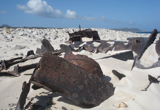
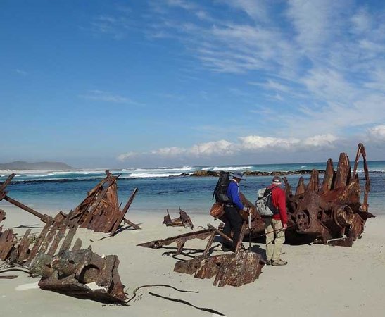
SS Thomas T. Tucker is possibly the most photographed wreck at Cape Point, and the birdlife that has taken up residence on the hull of the old ship makes for great photo opportunities.