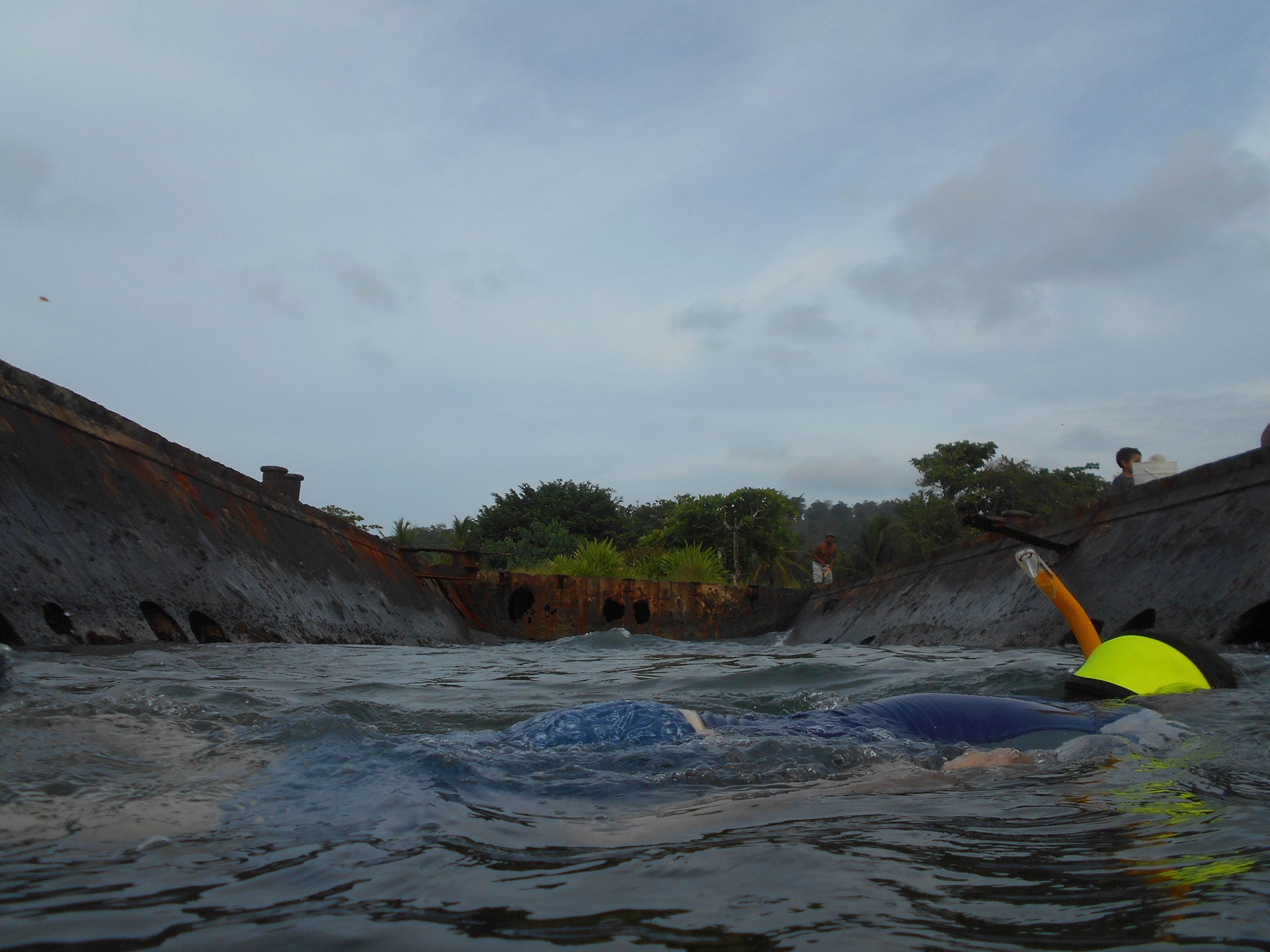
After a morning of diving, Dr. Richards, Hannah, Devin, Elise, Lauren, and I set out for an afternoon in Puerto Viejo, a town near Cahuita and home to one of our sites, El Lanchon. El Lanchon is the remnants of a 19th century oil barge used for transporting heavy machinery that was abandoned by Loffland Oil Company in 1963.
Before we left Cahuita, we had lunch at a French restaurant close to the bus station. The food was good, but the service requires a great amount of patience, similar to every other restaurant in Cahuita. We finished with our lunch and proceeded to the bus station where we had to wait for 35 minutes before the bus arrived. Mepe, the local bus, seems to run on “island time”.
We arrived in Puerto Viejo around 3pm and set to work immediately. Our task was to take several shots of El Lanchon from different angles with the aim of using a new software, called Agisoft Photoscan, to create a 3D model of the barge.
We divided into three groups: Dr. Richards and I had Camera ‘A’, Hannah and Devin operated camera ‘B’, and Lauren and Elise had camera ‘C’. Dr. Richards and I concentrated on taking terrestrial pictures of El Lanchon using a Nikon D-300 with Acquatica. This camera takes high quality photos but was limited in this instance because its lens cannot zoom. Lauren and Elise used a Cannon Powershot D10, a decent water resistant, point and shoot camera with limited functions, and were charged taking pictures from the water. Hannah and Devin took pictures of El Lanchon from the top and the water, using a Nikon CoolPix L26. This is another decent point and shoot camera, but they had to be careful to keep the lens dry while shooting to keep water spots out of their shots.
The tide made it difficult for Lauren and Hannah’s groups to take good pictures. Water visibility was also very poor and, as a result, few pictures were taken underwater. Dr. Richards and I found that getting good positions was more difficult than we anticipated.
After a while, Dr. Richards decided that we should snorkel the site to see if we could find more features. He snorkeled inside El Lanchon, while I concentrated on the surrounding environment. About twenty minutes of snorkeling yielded some results; we found a bollard, a feature on land or a pier to dock and tie a boat, approximately five meters off El Lanchon’s stern. Hannah took pictures of it while we continued snorkeling. Devin also joined us, but we had to stop when locals arrived to fish. While they did not expressly ask us to leave the site, the looks they gave us indicated that we were disturbing their activities.
We indulged in deserts while we waited for the bus to take us back to Cahuita. We arrived Cahuita around 6pm and agreed to meet at 2pm the next day to process the pictures we took. I cannot wait to see how this software will create a 3D model of the remains of the El Lanchon! … to be continued.
The next day… We have now regrouped to process the pictures we took yesterday. Dr. Richards uploaded the pictures from the three cameras and grouped them accordingly. He put them in the software and started the process of masking them. Masking allows us to take out the data we do not want to model; so, since we only want to create a 3D model of El Lanchon, we removed the water, sky, and background from the photos. Lauren and I also took turns masking the first set of pictures. The masking process is time consuming because of the number of pictures we took. About an hour passed before we were able to mask all 26 pictures from camera ‘A’. At the end, the program was happy with 23 of the photos. Dr. Richards suggested that it may have rejected the other three because of poor illumination.
After the masking process, it took approximately 10 – 15 minutes for the program to create the 3D model. A little tweaking here and there produced a fair 3D model of El Lanchon. Dr. Richards says masking the rest of the pictures will produce an even better result, but we have over 200 pictures between Lauren and Hannah’s cameras. I can only imagine how awesome this program is!
– Wale
