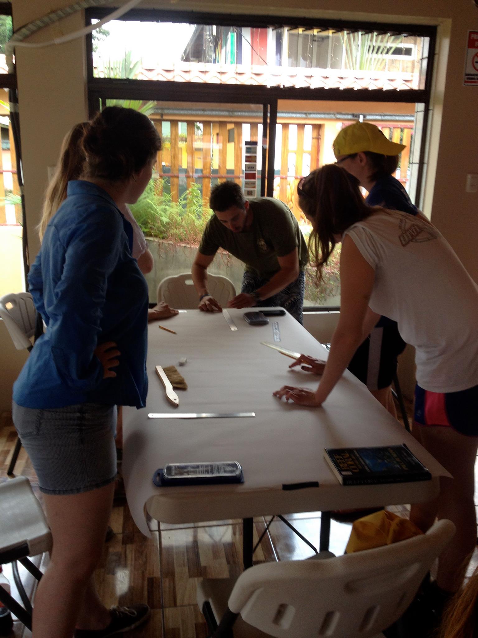
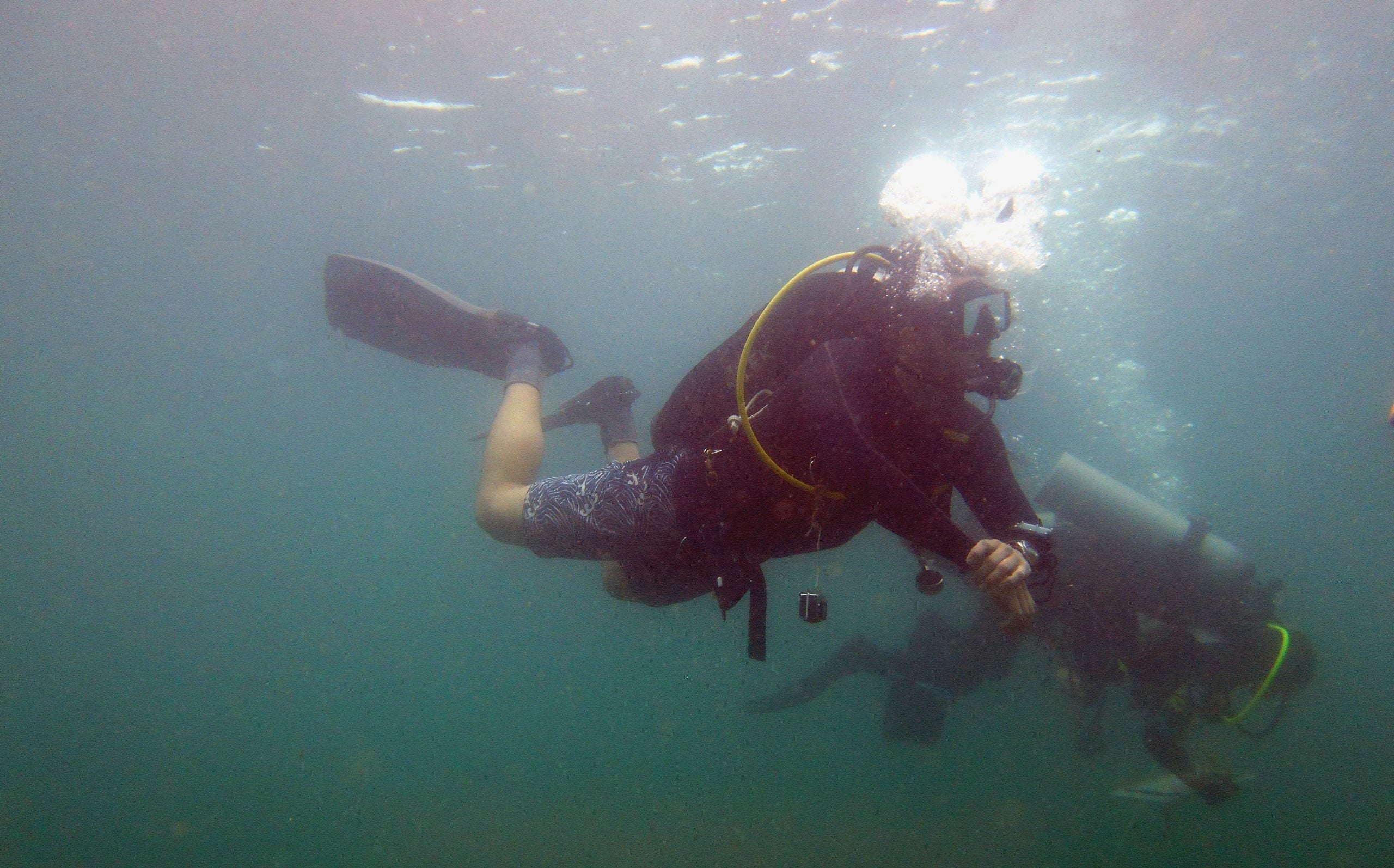
Sunday marked the end of the first week of our field school here in Costa Rica. For most of us, getting on the plane a week ago feels like the distant past. A lot has happened since we arrived in this beautiful coastal town. On any given day, we are up at 7am for breakfast. After a quick briefing, we take a short walk to Willie’s Tours and pick up our SCUBA tanks. From the tour office, it is another four-block walk in the tropical, Costa Rican heat with the tanks strapped to our backs and gear bags in hand. At the launch the local boat captains wait for everyone to arrive. The students load their gear into the fishing boats, and are off for roughly 3 hours of working on the sites. When we come back, we typically allocate 2 hours for gear breakdown and lunch. By 2pm, everyone is back at work either documenting the fishing boats, processing photogrammetry images, drawing the site plan, or recording their notes. We stop working around 6pm and meet an hour later for a debriefing to end each day.
Each person has put in long hours and handled a continually strenuous workload. The intensity of fieldwork, however, is definitely starting to show. As someone who has already gone through this process, and worked on a variety of projects both internationally and in the US, I can attest to the adjustment students need to make when living in the field. Fieldwork is hard. No matter how much we prepare, this kind of work takes a lot out of you. It shows a lot about the caliber of students we have that they continue to push forward despite the blood, sweat, and tears. They are all working together to get the job done – and this work ethic is reflected in the results thus far.
We labeled the two shipwreck sites we are diving on the Cannon Site and the Brick Site, respectively. In the past week, we began our efforts on the Cannon Site. Thirteen cannon were initially discovered on the site along with 2 anchors. By the end of the week all of these features were mapped in relation to one another and a fully scaled site map was produced. A recent discovery of bricks closer to shore will reignite our efforts on this site in the coming week.
On the Brick Site, our students helped to set up the site for traditional mapping methods using a baseline and taking offset measurements from that line. After only two days of work, almost half of the site has been mapped. This is the site where I have spent the most of my time during the diving portion of the day. The fundamental techniques the students are learning here form the heart of maritime archaeology. It is nice to observe and help the students while they are working with any of the difficulties that inevitably arise. After only a few days, they are all starting to get into a rhythm with their teammates to, not only learn the method, but work together to create an impressive product.
On the first day of fieldwork, Dr. Richards took several students out to El Lanchon to photograph the iron barge in its entirety. These photos could then be used with the photogrammetry program, Photoscan. In one afternoon the students got all of the data they needed and since that time have been chopping away at the data processing towards a full 3D model of the site. This is a very interesting part of the project and has allowed the students to experience not only the fundamental skills in archaeology, such as mapping a wreck, but also more modern computer-based archaeological techniques.
In addition to all of the above, the students have also recorded 5 small boats using both photogrammetry as well as traditional measurements. These boats represent the local fishing community of Cahuita, who have been instrumental to our project thus far. To learn more about Cahuitan culture, students have even engaged with several key members of not only the fishing community, but also a local musician who is famous for his upbeat Caribbean Calypso style. To document other forms of cultural heritage around the town, the students have also documented local artwork that is characteristic to the streets of Cahuita and Puerto Viejo. Through these fascinating interactions, the students are getting a much better appreciation of the distinct local Cahuitan culture.
Two site plans, the makings of a 3D model, 5 fully recorded boats, 3 interviews, and too many photos to mention – when I list it out, it does seem like a lot in one week! – but that is the mindset of this project. We are full steam ahead to learn and experience all that Cahuita has to offer before we have to pack up and leave. If we happen to listen to some awesome music, meet some amazing people, dive in the warm Caribbean water, and sample some tasty beverages along the way, then so be it. Pura Vida!
-Jeremy