An East Carolina University Collabrative Initiative – Department of Sociology, Department of Anthropology and Department of History Faculty and Graduate Students
Maps
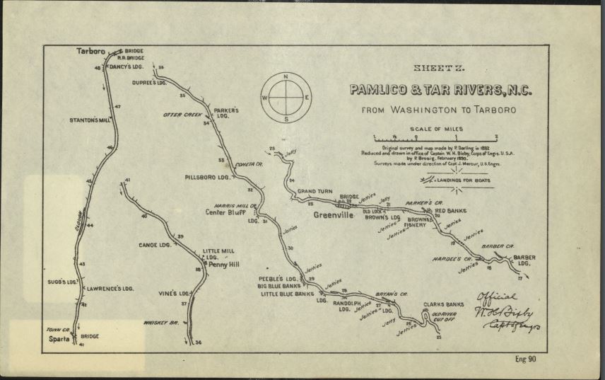
Original Map of Canoe Landings on the Tar River. Image courtesy of ECU Joyner Library
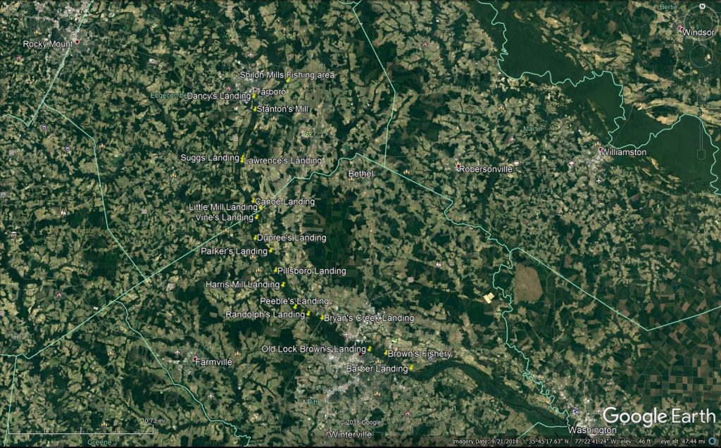
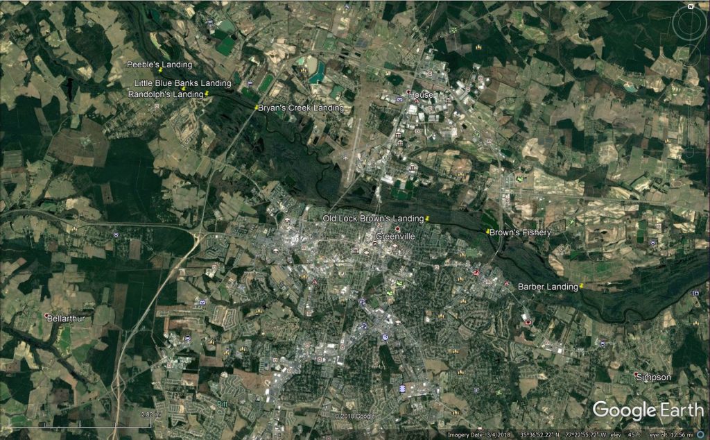
This map shows the locations of the canoe landings long the Tar River that were shown in the 1889 map (Image credit: Google Earth)
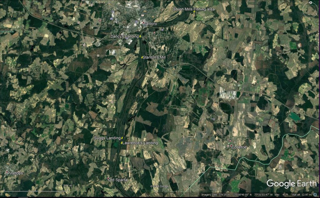
This is an enhanced of the canoe landings from Tarboro/Princeville to Old Sparta (Image Credit: Google Earth)
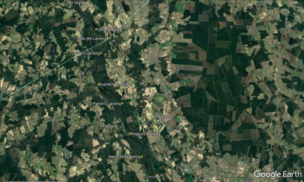
This is a enhanced view of the Canoe Landing from Old Sparta to Belvoir (Image Credit: Google Earth)
This is an enhanced view of the Canoe Landings from Belvoir to Greenville (Image Credit: Google Earth)