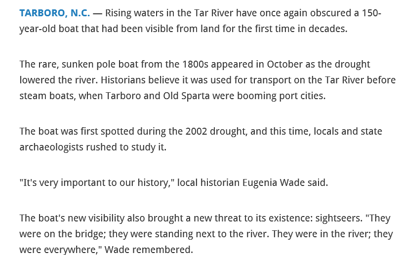
https://www.wral.com/news/local/video/1924301/
https://www.wral.com/news/local/story/2789384/
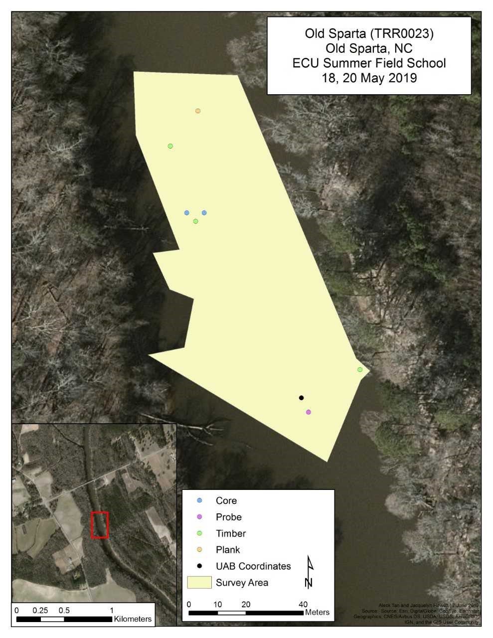
ECU Summer Field School 2019
Site Name/Number:
Tom Jones; Old Sparta 2; TRR0023
Location (Description and Coordinates):
Edgecombe County. Roughly 200 meters downstream on the Tar River from Route 44 bridge near the town of Old Sparta. The site can be reached by travelling downstream from the Old Sparta slipway. Coordinates take from western end of the site are 35°47’15.2’’N, 077°32’58.4”W using WGS 1984.
Date Dived/Inspected:
5/18/2019, 5/20/2019
Weather on date of Inspection (tide, etc.):
May 18 (Saturday): Sunny, 92°, current mean velocity ~1.1 feet per second. Wind ~5mph SW. The tide discharged was 1,250 cubic feet per second, gauge height 4.07 feet.
May 20 (Saturday): Sunny, 88° current mean velocity ~1 meter per second. Wind ~9mph SW. The tide discharged was 1,130 cubic feet per second, gauge height 3.94 feet
All measurements were taken at noon in Greenville Town Commons, NC (USGS Water Resources). The site was visited during extremely low water levels due to lack of rainfall.
Depth:
The depth will vary due to rainfall, and during the time of survey, the climate had been dry with little rain, and the river water level was low, making the depth of the site vary across the river between 1 and 1.5 meters.
Visibility/Current:
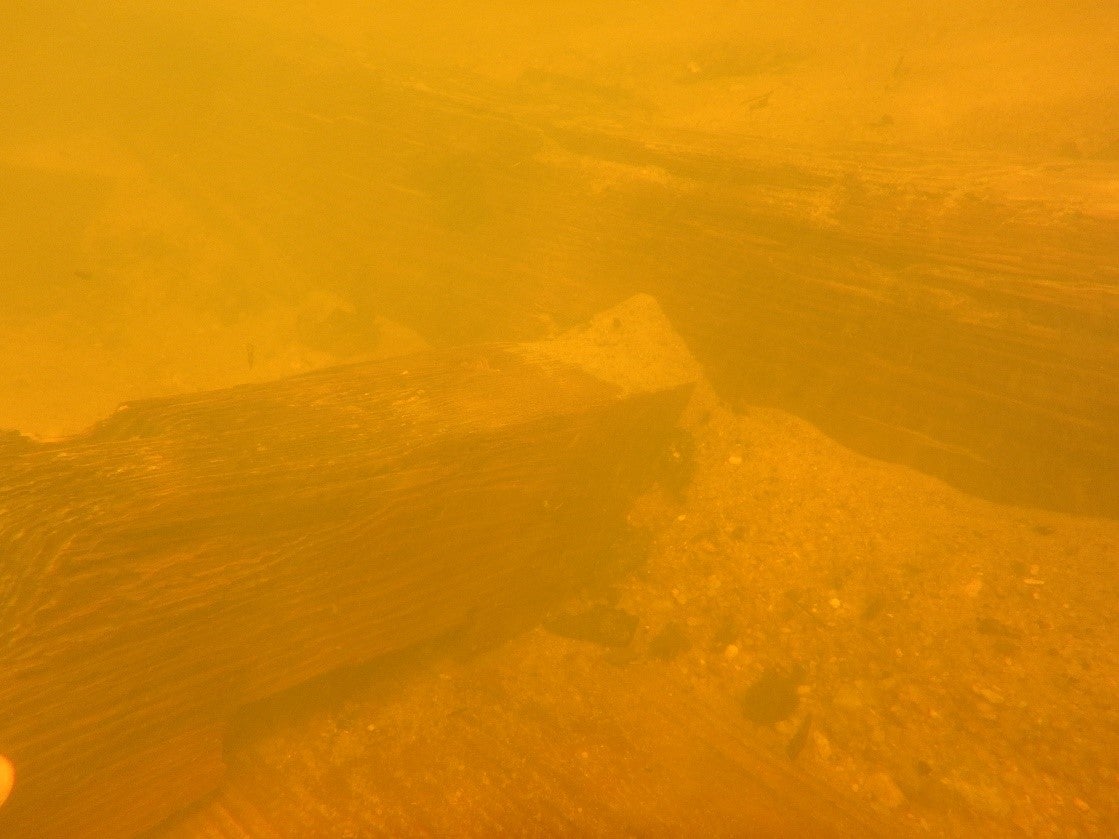
Visibility roughly half a meter.
Environment (general and biological):
Water dissolved oxygen percentage: 60% at surface, 66% at half a meter, 70% at bottom
Water temperature: 86.5° at surface, 85.5° at half a meter, 84.6 at bottom°
Natural vegetation include freshwater swamp chestnut oak, cherrybark oak, laurel oak, water oak, willow oak, sweetgum, green ash, shagbark hickory, bitternut hickory, waternut hickory and American elm (UNC Institute for the Environment). Side banks of river rise up.
Bottom Composition (sediment description, slope, topography, etc.):
The bottom varied from fine mud along the banks to medium sand and coarser gravel. At various points, the bottom rises above the surface. The site is covered in sand.
Brief Historical Context:
The vessel is believed to have been an 80 foot long flat bottomed barge from the mid-19th century. Vessel would have been powered by the current or wooden poles as well as ropes along the bank when working against a heavy current and used to transport goods back and forth between trading centers in Tarboro and Washington. Slave labor was used to pilot such vessels (Edwards 2015:72). The wreck stretches across the river from east to west, and had been exposed due to low water levels as recent as 2016. Similar barges had been excavated at Castle Island near Washington, NC, by East Carolina University’s Maritime Studies Department during field seasons 1998-2000. These wrecks were labeled in the report as Wreck One, Three, Nine, and Eleven (Rogers et.al. 2006).
Methods of Investigation:
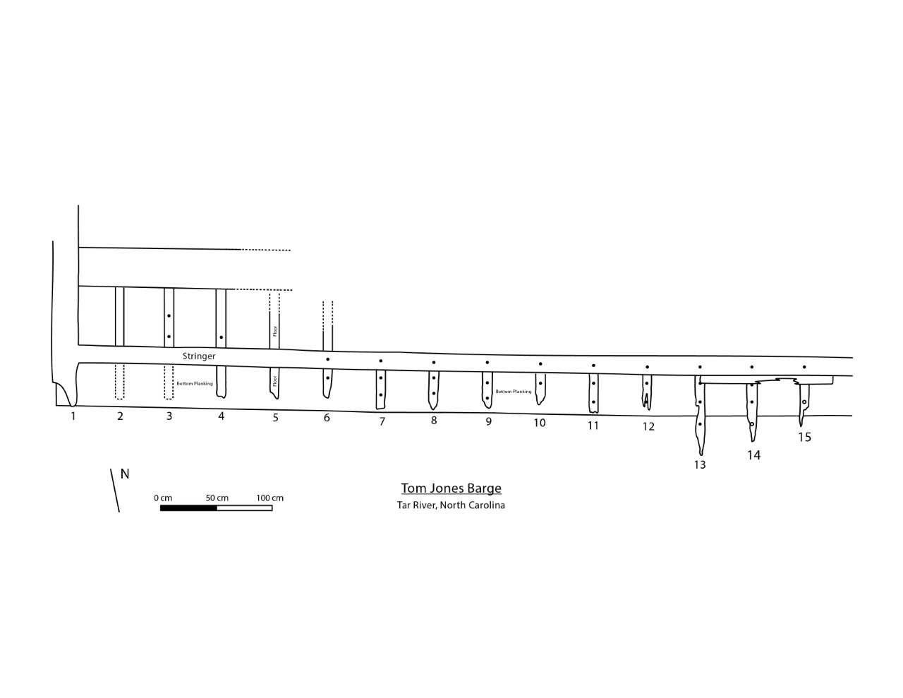
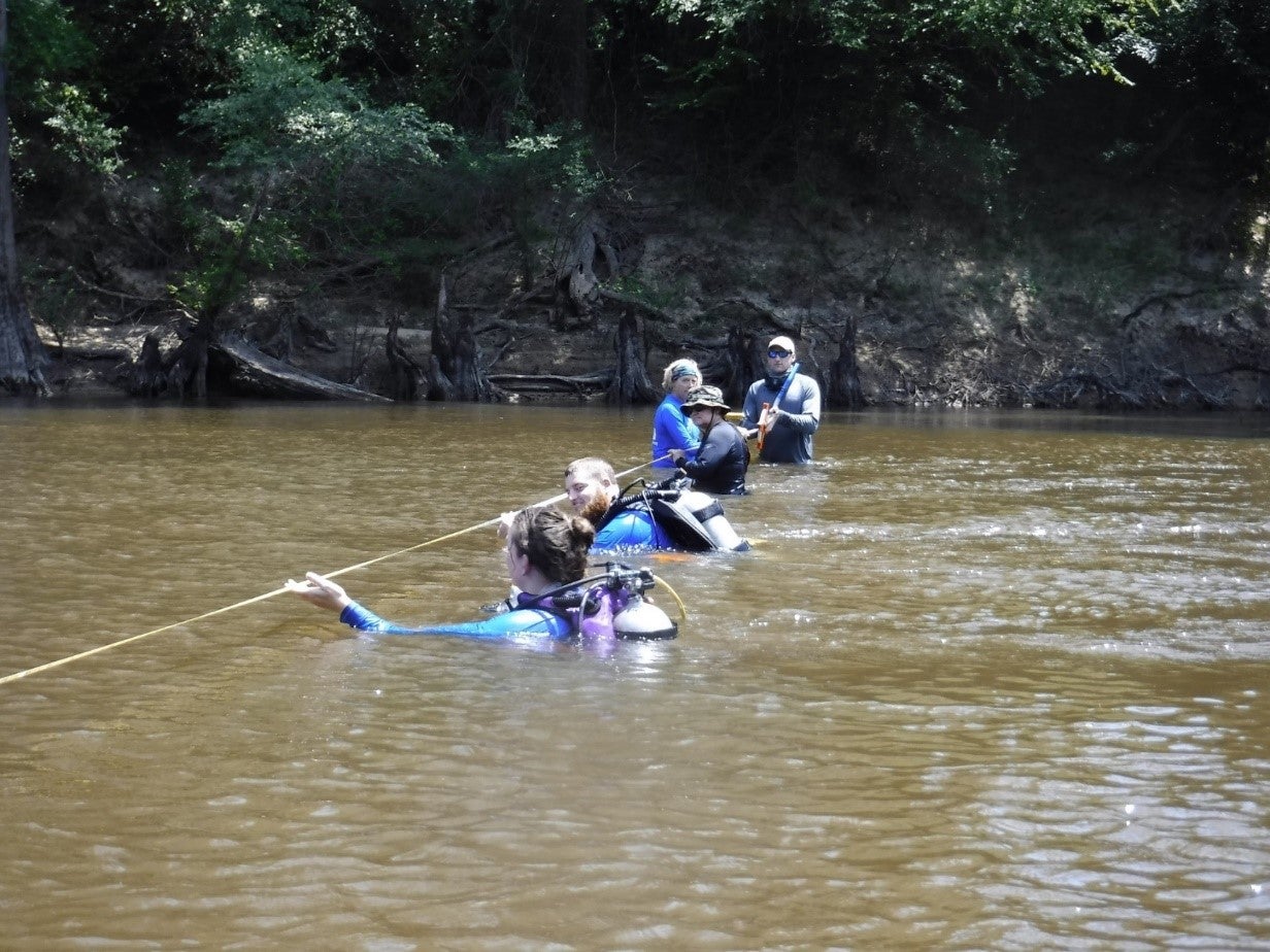
Line surveys and Garmin GPS units were used to relocate the site, which had been previously marked at 35°47’13.2’’N, 077°32’57.1’’W (TRR0023-UAB). The line surveys were conducted by spreading the team across the river and walking up and down river, with the person on the east end hugging the bank. The distance covered was roughly 100 meters. The first attempts proved fruitless, and so the photographs taken of the wreck during low water were viewed to get a better idea of the wreck with consideration to the shoreline and bridge. The photographs confirmed that the wreck was further upriver. Loose pieces of planking were discovered in the center of the river, coordinates 35°47’16.5’’N, 077°32’58.4’’W (TRR0023-1), marked Plank. The largest loose piece with nail holes in it was moved to the east bank. The indicating piece, a board running roughly east to west with planks running north and iron fasteners was discovered at the location given at the beginning of this report, marked as Plank, Timber on the map and is the southwest side of the diagram given (Fig. 2).
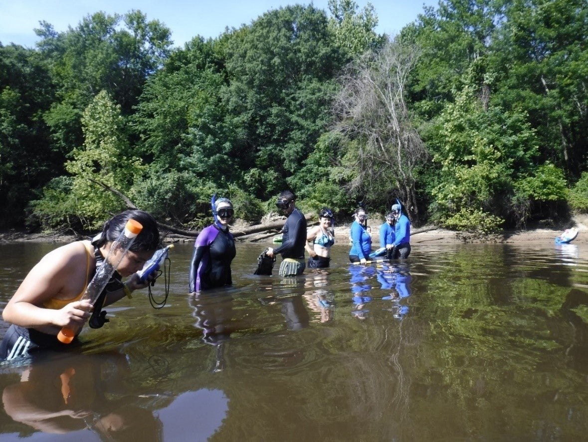
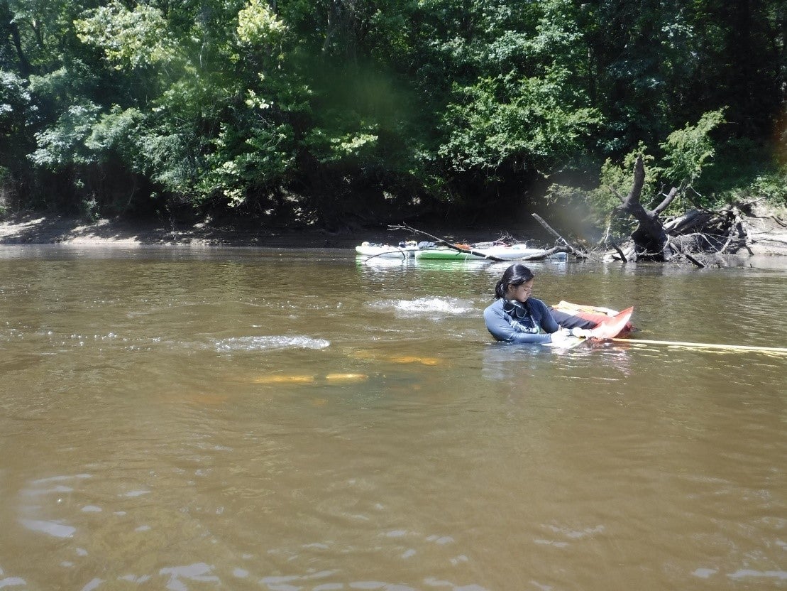
Hand fanning was used to remove the sand that covered the site. Garmin GPS units were used to take the coordinates of two bottom core samples, coordinates 35° 47′ 15.3’’N, 077° 32′ 58.3’’W (TRR0023-Core-1), and 35° 47′ 15.3″N, 35° 47′ 15.3″W (TRR0023-Core-2), marked Core on the map. Two Fujifilm FinePixXP cameras and a GoPro were used for photography/video. Photographs were taken of features next to 8cm scale cards. GoPros were used to take videos across the site. Dive tapes were used to take measurements and slates were used to record and draw site plans. The wreck was divided into three sections of three to four meters each from the western side. Teams using scuba gear were weighted to the bottom due to the current. Pieces of foam pool noodle were cut and placed over exposed iron spikes. Probes were used to test the total length of the site to compare to the description of the vessel as being 80 feet long.
General Description (of site):
The site is located in the center of the river running bank to bank, east to west. The survey section on the west end began approximately ten meters from the west bank and continued east (Fig. 2). The wrecks 80 foot length led to the east end of the wreck being located approximately another ten meters from the east bank. The team had discovered planking on the western end. The team divided up into groups of two to hand fan, map and photograph every five running boards that came out from the stringer board and pointed south, covering an average of around twenty centimeters before being cut off. Attached under the running boards on the south was a flat wooden baseboard that connected the running boards to the stringer from underneath. The boards were numbered for identification along the stringer, with Board #1 being on the west side. Board #1 was larger than the other boards and continued further north, going over another flat board that again ran east to west. Between the flat board and the stringer, the running boards continued from beneath the stringer, continuing north parallel to Board #1, until coming the flat board to the north. These running boards between the stringer and flat board were below the level of the stringer in the water column and remained buried after Board #6 (see Fig. 2). The section of running board on Boards #2 and #3 on the south side of the stringer were missing, with iron nails protruding from the baseboard marking their locations.
These nails had to be covered with pieces of pink foam noodle to prevent accidental injury. The current of the river caused several divers to hold onto features or dig into the sand to keep from being pushed further south. The water was low, and various shallow spots in the center of the river could be seen from the surface. Both shorelines were steep and muddy.
Features (Natural and Cultural):
Cultural features include the partially buried portion of the wreck that was mapped and marked. Also included is a boat launch located on the east side of the river a few hundred meters north of the site, and the bridge that runs east to west over the Tar River around 50 meters past the boat ramp. Natural features include the riverbanks flora.
Artifacts:
Loose pieces of planking, some with fastener holes were all the artifacts associated with the site. A golf ball, aluminum can, and various other pieces of modern litter were found in the river near the site. The planking that contained the metal fastener was measured to be roughly 1.4 meters long and 20 centimeters high (Fig. 4)
Human or Environmental Impacts:
The river is a constant source of burial and reburial from the current and storms. Human impacts include litter that moves from upstream.
Potential Threats:
A similar site a few hundred yards upriver and below the Route 44 Bridge had been uncovered by low water and storms, and souvenir collectors began to pillage the site before local policy enacted protection of the site. The threat is that the site becomes discovered and ravaged by souvenir collectors.
Associated Artifacts onshore or nearby (i.e. museums, private collections):
The Old Sparta Historical Society was founded to initiate protection and further public education after the site beneath the bridge was revealed (WRAL Local New).
Associated References:
Edwards, Justin Randolph
2015 Tar River Blouts and a Transitional Maritime Landscape, 1778-1802. Master’s thesis, Department of History, East Carolina University, Greenville, NC.
Rogers, Bradly A., Nathan Richards, Franklin H. Price, Brian Clayton, Drew Pietruszka, Heather White, Steve Williams.
2006 The Castle Island Ships’ Graveyard: The History and Archaeology of Eleven Wrecked and Abandoned Watercraft. The 1998-2000 Castle Island Field Seasons. Program in Maritime Studies, East Carolina University, Research Report No. 14. Greenville, NC.
United States Geological Services
2019 USGS 02084000 Tar River at Greenville, NC. USGS Water Resources, USGS. https://waterdata.usgs.gov/nwis/uv?cb_00045=on&cb_00060=on&cb_00065=on&cb_72255=on&format=gif_default&site_no=02084000. Accessed 6/12/2019.
University of North Carolina Institute for the Environment
2014 Natural Environments of the Tar-Pamlico River Basin, adapted from Ecoregions of North Carolina and the Tar-Pamlico River Basin Plan 2010. University of North Carolina, pp.1-3. Chapel Hill, NC.
WRAL
2008 Rains Cover Rare Boat in Tar River. WRAL Local News June 24. Tarboro, NC. Accessed 6/12/19. https://www.wral.com/news/local/story/2789384/.
Future Research Potential:
The wreck itself can be further excavated, mapped, and photographed. A full site plan can be made once other sections are exposed. Research on the origins of the wood used, the vessel’s identification, cargo (if any), ability to maneuver, cause of loss, ownership, construction, etc.
Future Public Outreach Potential:
Features of the site can be raised and placed on display. Digital photogrammetry of the site can be used on historical websites.