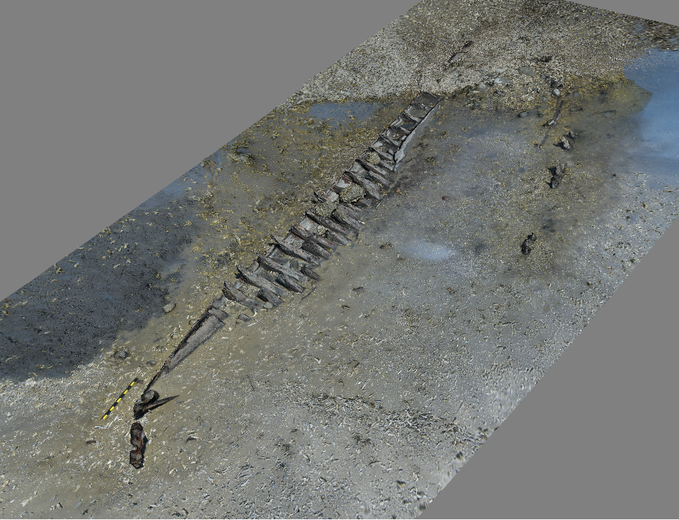
The Maritime Heritage at Risk team utilizes photogrammetry to collect rapid, 3-dimensional data from 2-dimensional photographs. The benefit of photogrammetry is that any camera can be used to collect the images, from a professional SLR to a cell phone. Images can even be extracted from high-resolution video taken with common video cameras, such as GoPros. This flexibility has made photogrammetry a popular low-cost solution for archaeological documentation with minimal technical knowledge required to utilize the methodology. In the field, the team follows a pre-determined flight plan over a site to collect enough overlapping images to import into the photogrammetry software. Depending on the size of the site, hundreds or thousands of photos may be taken.
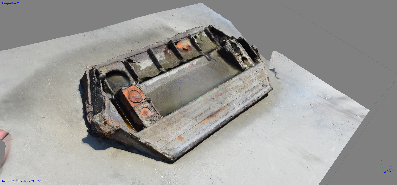
Once the data set of images is collected, the photos are imported into the commercial software package PhotoScan, by Agisoft LLC, to post-process the images and render the 3D reconstruction. The software utilizes a Computer Vision (CV) algorithm to reconstruct the 3D structures of a site by finding common features or points among the set of images, taken from different vantage points of the given subject, and processes these images to derive virtual depths and geometry of the structures photographed. The CV algorithm automatically calculates the interior and exterior camera parameters, or camera locations and settings in virtual space, using the corresponding features of each consecutive photo in the dataset to orient the images, which generates a sparse point cloud of the object. This allows for further dense point cloud generation, surface or mesh reconstruction, and texture mapping. Using PhotoScan, the site can then be scaled appropriately, an orthomosaic plan view of a site or artifact can be delineated, or the 3D file can be imported into a digital animation program for further analysis and interpretation. The versatility and practicality of PhotoScan has made it one of the most widely used programs in archaeological or historic preservation studies.