Site Name/Number: Portsmouth Island Shoreline
Location (Description and Coordinates): Portsmouth Island, Hyde County, North Carolina
Date Dived/Inspected: 4 June 2019
Weather on date of Inspection (tide, etc.):
On June 4th, the high was 81 degrees, with a low of 65. The wind blew from the South at an average speed of 7.7 mph, gusting up to 19 mph. The first high tide was at 8:52 am and the following low was at 1:47 pm.
Depth:
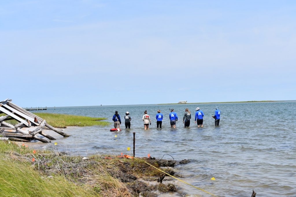
The shoreline survey conducted encompassed a search area from the waterline to approximately 20m inland and to 20m out into the sound. The terrestrial team surveyed the inland half, while the water team waded through ~0-1m water in the Pamlico Sound.
Visibility/Current:
Visibility from above water, looking down at material culture such as bricks, surrounded by tufts of oyster beds, ranged from 0m to approximately 1m, depending on the sun angle. If the sun was behind our search line, we could see the bottom. If we were walking into it, the visibility was close to nothing. Additionally, as we walked and stirred up the bottom, the visibility decreased, especially when we pursued our survey area up Doctor’s Creek, by Henry Piggot’s house. There was little current affecting our walking.
Environment (general and biological):
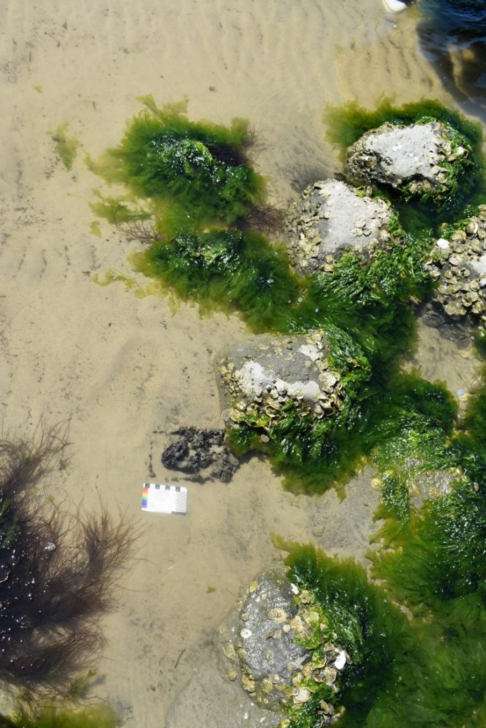
On Portsmouth Island, the ecological environment ranges from beach to salt water marsh, to grassland and brush further inland. It is microtidal, influenced by changing tides daily. The sandy ground grows tall grasses well, which host countless types of crabs and insects. Specific to this site are the biting flies such as horse flies and greenhead flies. The mosquitoes are abnormally large, but not as numerous as the flies. The water’s edges are both white sand beaches and marshes built up with layers of oyster shells and mud and grasses.
Bottom Composition (sediment description, slope, topography, etc.):
In the waterline directly aligned with the sound, the bottom composition from the beach going into the water was sandy, interrupted by fractures and tufts of marshy grass and oyster beds. As the water team followed canals into the island, the bottom became more saturated with slack-tide water and mud, resulting in silty slack-water deposits. The team’s steps sank progressively further into this shell-laden mud until they were all knee-deep in it. On shore, a smaller team conducted a land survey across the sandy ground and thick, grassy oyster marshes.
Brief Historical Context:
The first mention of the Portsmouth Island settlement came in the 1680s, describing it as being on the south side of Ocracoke Inlet. By the early 1700s, the area had become a small colony, with early landowners’ names including Shackleford, Ward, Moy, Worden, Simpson, Bell and Fulford. By the 1770s, Portsmouth was one of the largest settlements in the Outer Banks. It was primarily used for lightering, the process of removing enough cargo to make the ship light enough to cross the inlet’s sand bars. (National Parks Service 2007 Portsmouth Village Cultural Landscape Report)
Methods of Investigation:
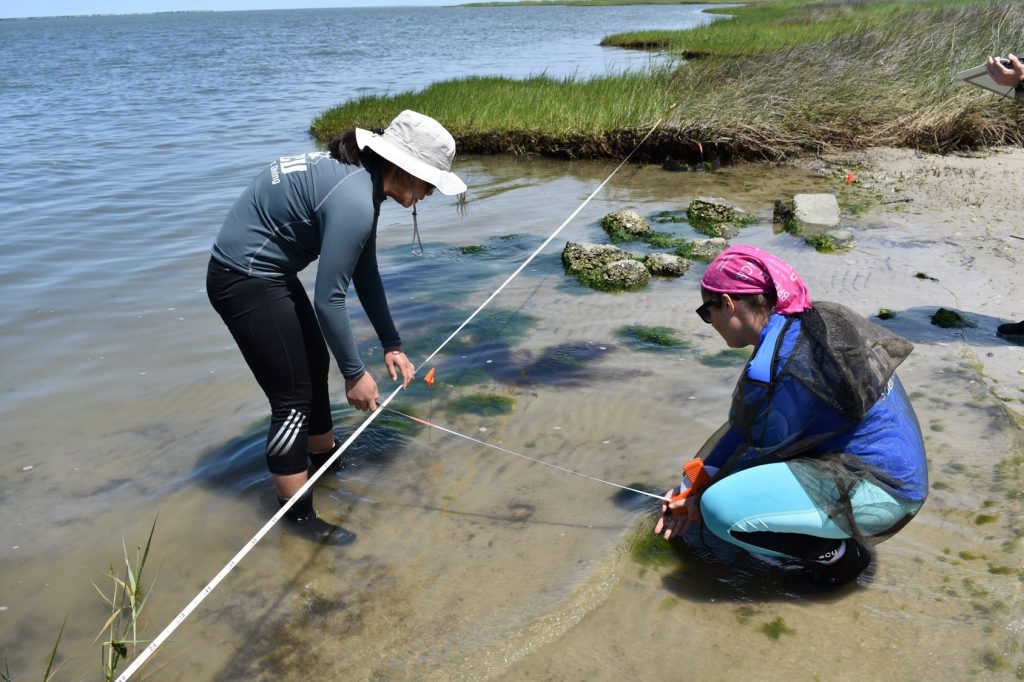
The water-bound shoreline team conducted line searches with a tape measure, GPS units, a camera, pocket scales, and slates for recording any artifacts we discovered. For this particular search, we were spaced at 1m intervals along the tape, feeling the bottom with our feet for any objects which might be material culture eroding out of the shoreline. Periodically, we would stop to investigate a potential object, reaching down in the water to determine whether it was of human or natural origin. We marked locations of every human artifact, colonial or recent, with the GPS and photographed them on a slate next to a pocket scale.
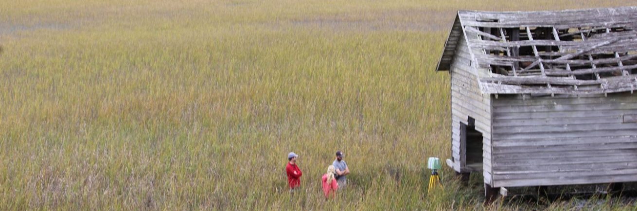
The land-bound shoreline team conducted a surface-survey to find any cultural artifacts. They flagged each artifact in order to return to them after surveying the whole area. Upon returning, they established baselines and used baseline-offset measurements to record each object’s location for mapping later. They took GPS locations of the ends of the baselines, as well as photos of each diagnostic artifact with either the pocket scale or 1m scale, depending on the photo size.
General Description (of site):
This shoreline changes constantly with ebbing and flowing tides eroding it. Occasionally, there will be dramatic changes due to opening and closing inlets from high-velocity natural weather events like hurricanes and tropical storms. As such, artifacts from the site’s whole history (nearly 400 western cultural years) are unearthed, shuffled, and reburied regularly. There will almost always be artifacts from every period visible on the surface of the land or reachable just under the water.
Features (Natural and Cultural):
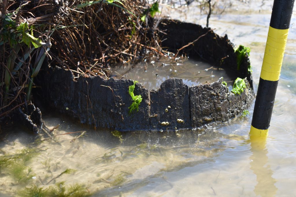
Features of the site include oyster beds, marshes, beaches, and a variety of wildlife including fish, crabs, snakes, insects, spiders, rays, skates, and sea birds. Cultural features which remain are maintained houses and buildings from the historic Portsmouth community, as well as cemeteries, and artifacts from their livelihoods: ceramic pieces, barrels, bricks, ballast stones, metal shards, coins, etc.
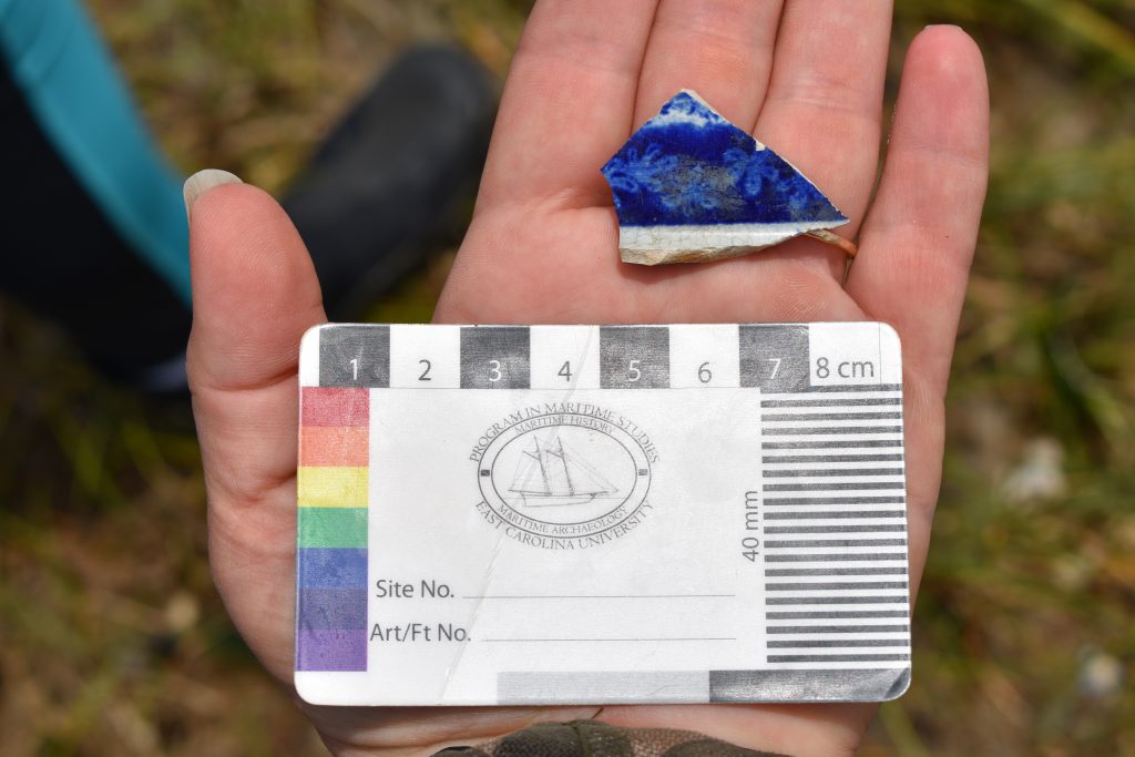
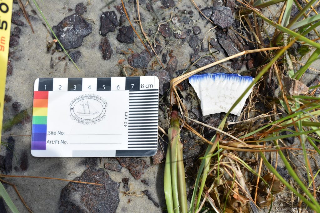
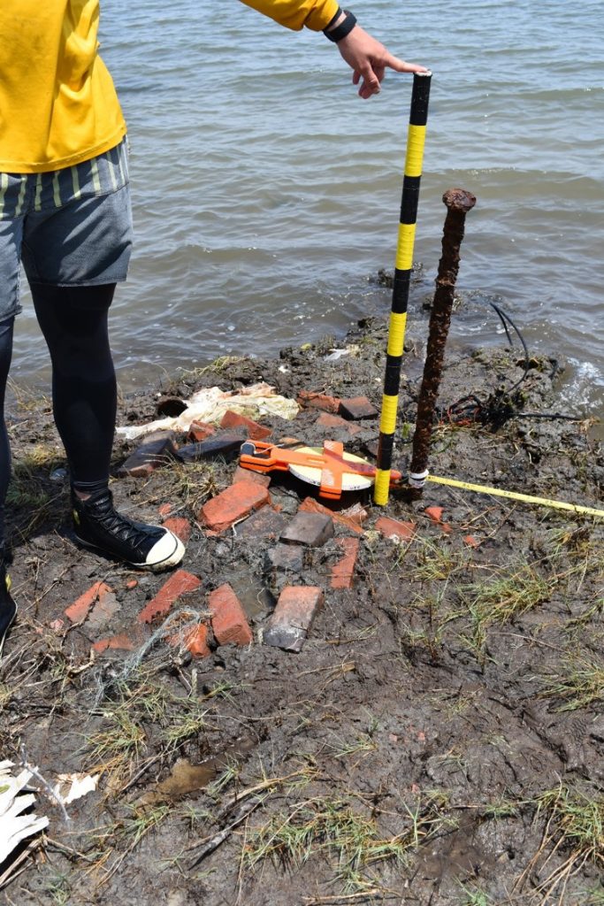
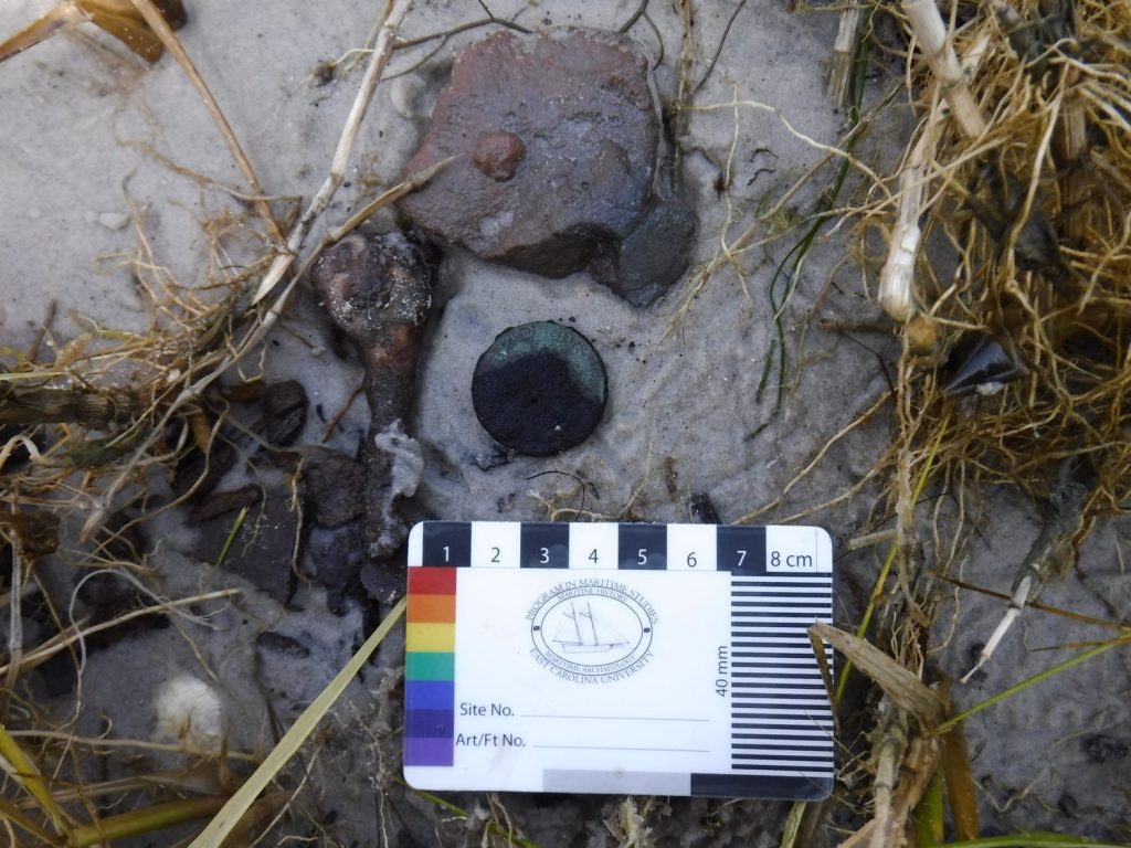
Artifacts:
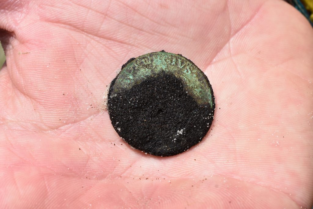
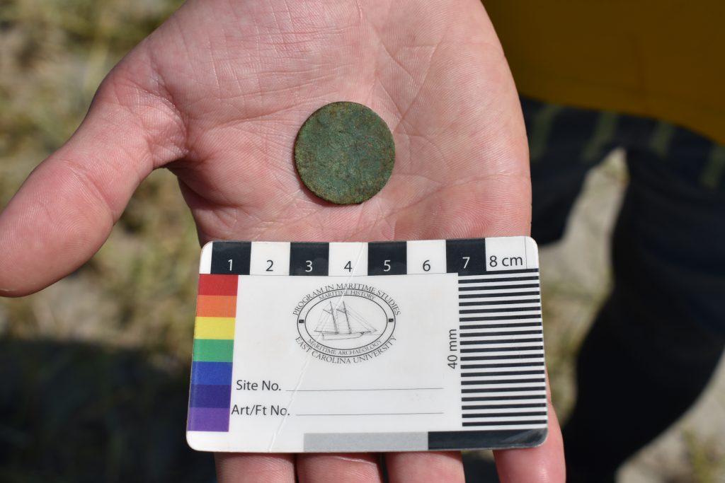
Both shoreline survey teams located numerous fragments of brick, pottery, metal, and wood. Most interestingly, the terrestrial survey team found an imitation British halfpence, from the 1780s.
Included below are photos representational of the artifacts we found. In order, there are two images of pottery, brick fragments, three images of a coin, a submerged fragment of metal, and a buried barrel from the terrestrial survey, followed by a bottle found by the water-bound team, and concluding with two images of the surveys being conducted by both teams.
Human or Environmental Impacts:
This particular site is subject to dramatic human and environmental impacts, as it is a regularly traversed state park, with daily tours and visitors, and a barrier island, vulnerable to hurricanes and tidal shifting.
Potential Threats:
While some of the aforementioned human impacts could include efforts for preservation and maintenance, the majority of all impacts to this island are detrimental to the archaeological history. Even the island’s growth, while it strengthens and sustains the land itself, could be considered destructive to the site’s archaeological integrity when artifacts are moved and buried. Also, foot traffic from its Historic State Park status likely often results in loose artifacts being removed from the site without being documented.
Associated Artifacts Onshore or Nearby (i.e. museums, private collections):
Related to our search area and the articles found within it are the homes or Frank Gaskill and Henry Piggot, as well as the Grey Menhaden factory. Due to their proximity to the shoreline survey areas, they are primary potential sources for the artifacts we found.
Future Research Potential:
Following up with the artifacts the shoreline survey teams found, identifying the history of the ceramic fragments, coin, glasses, and bricks would be relevant for adding to or corroborating what is already written regarding the Portsmouth community’s lifestyles through the ages.
Future Public Outreach Potential:
The artifacts have a number of current, intriguing public interactions. Not only is the island a Historic Park, but there are private collections which some individuals make available to small public audiences, and some artifacts from the island have been removed and taken to various places on Ocracoke Island. These types of sites could be aligned with state records, depending on individual compliance.