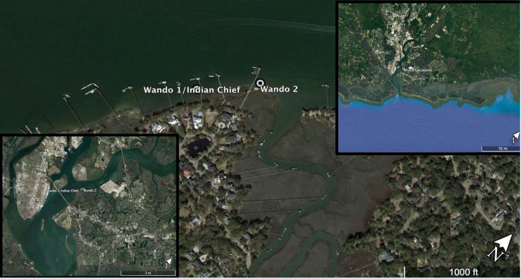
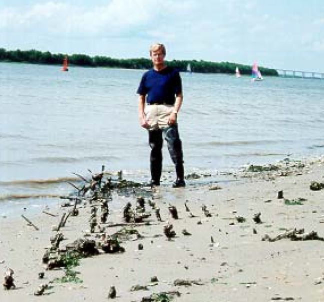
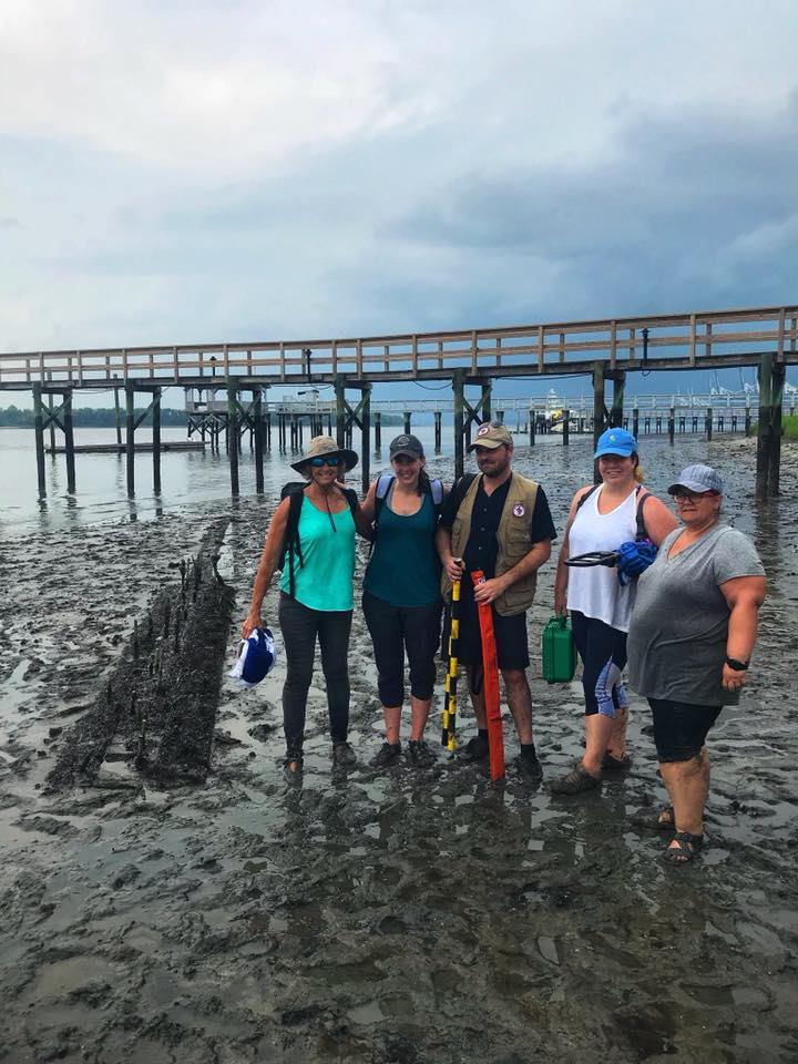
The two Wando River wrecks were reported to South Carolina Institute of Archaeology and Anthropology by a local Julian Weston of Mount Pleasant in 2002. In July our ECU team visited the wreck with Nate Fulmer of the Maritime Resources Division, Charleston office. Both wrecks are located on the shoreline at Remley Point, Mount Pleasant where rapid sub division development is occurring and new docks abound.
River Reach at Remleys Point is a small, highly exclusive, luxury, subdivision located along the Wando River and Molasses Creek with ancient oak trees, beautiful vistas and spectacular marsh views The wreckage is situated in the marsh between docks and only visible at low tide.
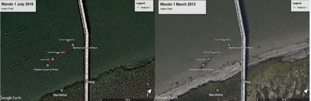
WANDO 1
Wando 1 wreckage located at N 32 degrees 49′ 05.7″ W 79 degrees 54′ 14.0″ comprises three substantive timbers, either outer hull or lower hull planks, running approximately parallel to the shoreline at a 312 degrees NW. The center plank extends 14.85 meters, the shore line plank 5.92 meters and the water side 5.88 meters. Top surfaces of the planks are very eroded. The edge of the shore most plank was 10 cm thick but an eroded wood casing around a fastening suggest it was originally between 18 to 20cm thick.
Most distinctive features on this wreck are the fastenings. Forty three long Muntz alloy spikes protrude from the planks ranging from 10 to 50cm in height. Some are bent over or clinched. The planks are joined edge to edge with a 10cm vertical fastening. This is evident from smoothly drilled, but empty, fastening grooves. From the outer edges of the planks, 10 cm of still attached muntz sheathing is evident.
Muntz’s was a 60:40 alloy of copper and zinc, also called ‘yellow metal’, The bolts were durable and easier to drive through heavier woods like oak. It also replaced copper as the preferred sheathing and fastening medium. Sometimes (as with the copper form) heads of Muntz or Yellow Metal bolts were ‘clinched’, ‘upset’ or ‘peened’ over circular clinch rings to become ‘clinch bolts’, or were clinched at both head and end, to become double-clenched rivets. Large circular section copper alloy nails—or short bolts called ‘dumps’.
On December 17, 1832, George Frederick Muntz submitted patent No.6347 promoting Muntz as a favorable and durable fastenings for ships. The invention consists in making such fastenings of “an alloy of zinc and copper, in such proportions and of such qualities as while it enables the manufacturer to roll and work the said compound metal into bolts and other the like ships’ fastenings at a red heat, and thus makes” such “fastenings less difficult to work, and consequently cheaper to manufacture, renders” them also “less liable to oxydation, and consequently more durable than the ordinary bolts and other the like ships’ fastenings now in use.” “I take that quality of copper known in the trade by the appellation of ‘best selected copper,’ and that quality of zinc known in England as ‘foreign zinc,’ and melt them together in the usual manner in any proportions between fifty per cent. of copper to fifty per cent. of zinc, and sixty-three per cent. of copper to thirty-seven per cent. of zinc. both of which extremes and all intermediate proportions will roll and work at a red heat,” but “I prefer the allow to consist of about sixty per cent. of copper to forty per cent. of zinc.”
[Printed, 3d. No Drawings. See Repertory of Arts, vol. 16 (third series), p. 12; and London Journal (Newton’s), vol. 3 (conjoined series), p. 83.]
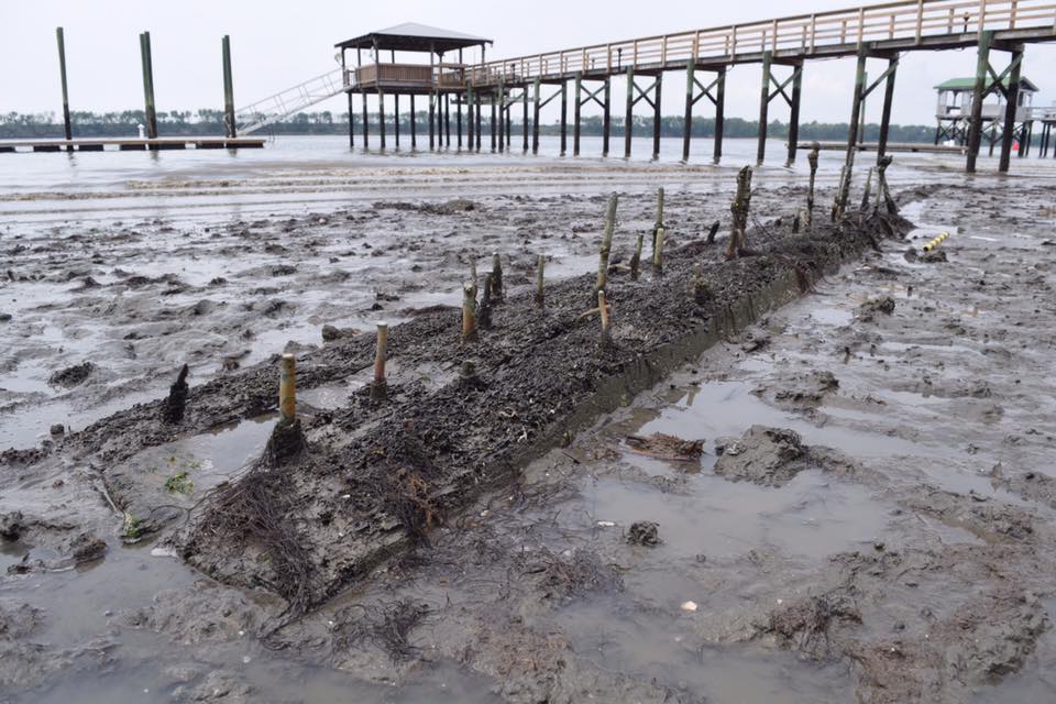
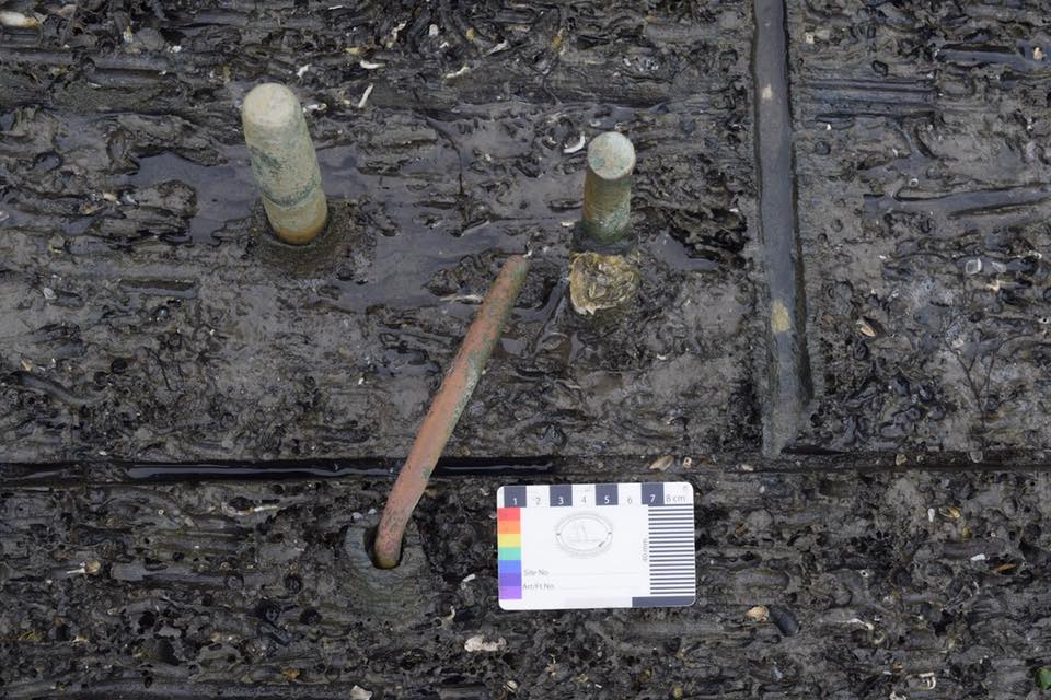
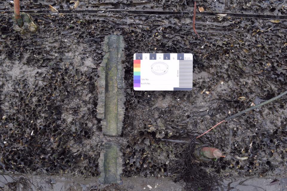
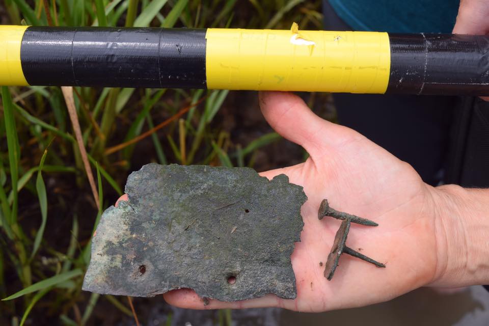
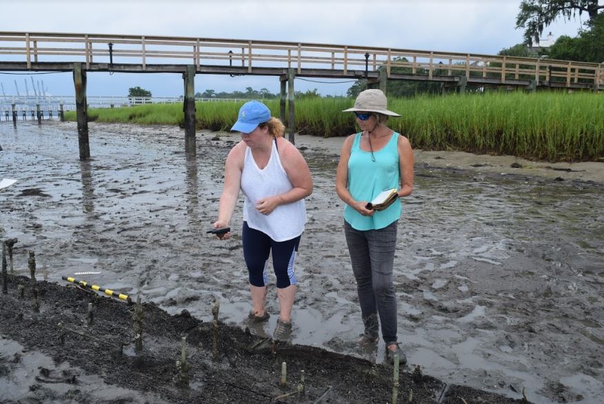
TABLE OF TIMBER MEASUREMENTS (Compiled by Kelsey Dwyer)
| Description | Measurement |
| Total length | 14.84 m |
| Inner Sided plank | 27 cm |
| Center sided plank | 27 cm |
| Outer sided plank | 27 cm |
| Planks molded | 10 cm |
| Planks sided | 27 cm |
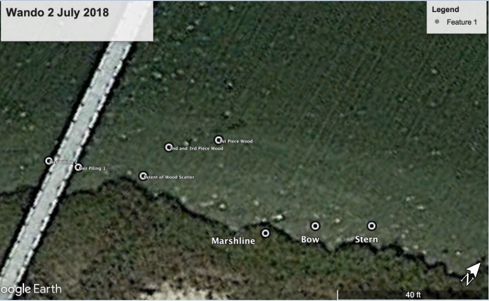
WANDO 2
The wreckage (4.80m in length) located at N 32 49′ 05.9″ w 79 54′ 14.6″ lies orientated parallel to Wando River crushed onto the starboard side with port side exposed. Essentially it is a flattened profile port view. The stern and stern post is located on the NW extremity. The wreckage comprises 2 strakes of the outer hull port side planks and the inner faces of five frames exposed where planks are missing. Fastenings are abundant, especially in the stern area and include copper sheathing tacks and holes for trunnels. The best preserved portion is the stern area (1.32m in width) becoming, with timbers increasingly eroded towards the bow (91cm in width). Evidence of burning is evident in the stern area.
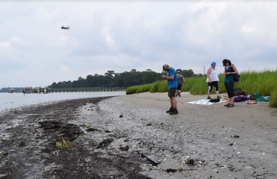
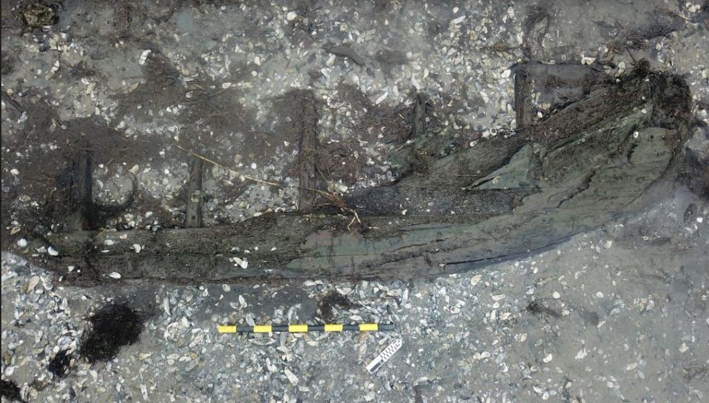
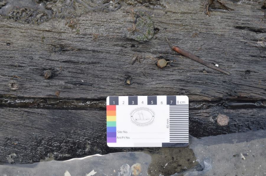
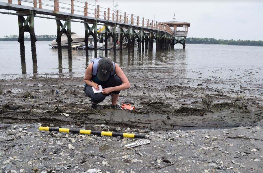
TABLE OF TIMBER MEASUREMENTS (Compiled by Kelsey Dwyer)
| Description | Measurement | |
| Total length | 4.38 meters | |
| Width at stern | 1.32 m | |
| Width at bow portion | .91m | |
| Stern post: | ||
| length | 88cm | |
| width | 7cm | |
| Frames: (1-5) Length | ||
| 1 | 57 cm | |
| 2 | 46 cm | |
| 3 | 67 cm | |
| 4 | 28 cm | |
| 5 | 39 cm | |
| Frames (1-5) Room and Space | ||
| 1 to 2 | 67 cm | |
| 2 to 3 | 67 cm | |
| 3 to 4 | 70 cm | |
| 4 to 5 | 67 cm | |
| Frames (1-7) Molded and Sided | Molded | Sided |
| 1 | 28 cm | 19 cm |
| 2 | 17 cm | 19 cm |
| 3 | 19cm | 2cm |
| 4 | 16 cm | N/A |
| 5 | 18 cm | 19 cm |
| 6 | 18 cm | N/A |
| 7 | 18 cm | 6 cm |
| Stern Post Length | ||
| Shore most plank | 19cm | |
| Middle plank | 17 cm | |
| Water most plank | 34 cm | |
| Disarticualted Wood length | ||
| Shore most piece | 34 cm | |
| Middle piece | 1 m 9cm |
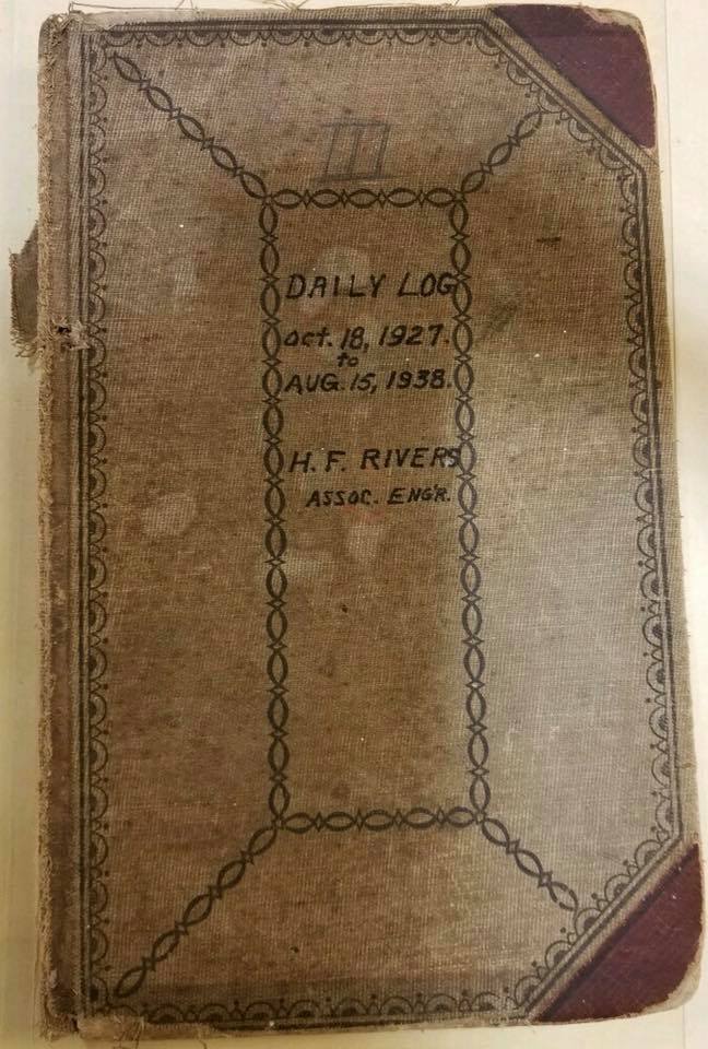
HISTORICAL CONTEXT
There is a possibility that this wreckage represents remnants of Civil War wrecks dumped on the river banks in the 1920s during dredging operations recorded in the logbook of Associate Engineer, H.F. Rivers. Amongst these vessels that matches the description is that of CSS Indian Chief. He wrote a description of the discovery in his logbook.”Its ribs were 12′ X 12′ mahogany timbers, butting each other on the keel. They were solid but as usual when sunken timbers are exposed they dry rot in a short time…Beautiful handmade brass spikes & long copper drift bolts hold the hull together.” Rivers concluded that these were the remains of a ship dating back to the Civil War the Confederate receiving ship––CSS Indian Chief. “The Indian Chief was a 3-mast schooner of heavy timber construction sheathed with Muntz metal. Appearances indicated it to be 150′ long. Removal completed July 7, 1929,”Rivers noted in his logbook. While this wreckage may not be remains of the CSS Indian Chief, but it has some similar construction details. There is a possibility that it is of the same vintage and may be associated Civil War
activity in the general area.
Between July and August of 1929, the U.S. Corps of Engineers found three more wrecks. These were identified as former Confederate navy vessels CSS Palmetto State, CSS Chicora, and CSS Charleston. Rivers describes the CSS Chicora as 150 feet long, 35 feet in beam and a 12 foot depth of hold. Armor: two layers of iron plating laid upon a 22 inch backing of oak and pine. Plating was continued below the waterline and also covered the ram that was a strong elongation of the bow. 500 tons of iron used in her armor and she was propelled by an engine with a 30-inch diameter cylinder and 26 stroke driving a three bladed screw eight feet in diameter. Battery: 2-9 inch smooth bore guns and 4 rifles, 32-pounders each.
Historians believe there were probably more trained seamen in the Charleston squadron than any other. Many were enlisted foreigners. Incontrast to the other Confederate squadrons, three African Americans served aboard the ironclad CSS Chicora. The crews of the Charleston squadron had a reputation of being well trained, very disciplined and having a respect for their officers. The vessels were known as the cleanest and of great credit to the Confederate navy. There are a number of associations between these vessels and the H.L. Hunley. In October 1863, the H.L. Hunley practiced numerous dives under CSS Indian Chief for training purposes. The H.L.Hunley sank, resulting in the death of the crew and inventor Horace Hunley, although the submarine itself was recovered. In November of the same year, Lieutenant George Dixon, commander of the H.L.Hunley‘s last mission, obtained permission from General Beauregard to ask for volunteers for the submarine from the crew of CSS Indian Chief. Despite the fact that only a month before these sailors had witnessed the fatal sinking of the H.L. Hunley, there were volunteers. Two other confederate vessels, CSS Chicora and CSS Palmetto State also supplied volunteers for the earlier crews of the H.L. Hunley.
ENVIRONMENT
Nearly two thirds of the state of South Carolina lies in the coastal plain, which stretches 80-90 miles from the Atlantic Ocean to the piedmont province. The Charleston area lies in a marine coastal terrace region, or low country, less that 270 feet abound sea level. Drained by large rivers and numerous tributaries, the area is part of the pamlico coastal terrace, a nearly level plain subject to inundation (Cooke 1937).
The site/s lies on the Wando River, a tidewater river that empties into the Cooper river at Charleston harbor. This tidal flat, based on Pleistocene sand, shell, and clay, is attached to substantial marsh land which is subject to scraping and erosion (Smith 2016).
Typical marsh wildlife, particularly small crab, accompany dolphin and alligators, as well as land-based animals such as white tailed deer. Residential development has been rapid since 2005, and large homes with accompanying extended docks are continuously appearing along the shoreline.