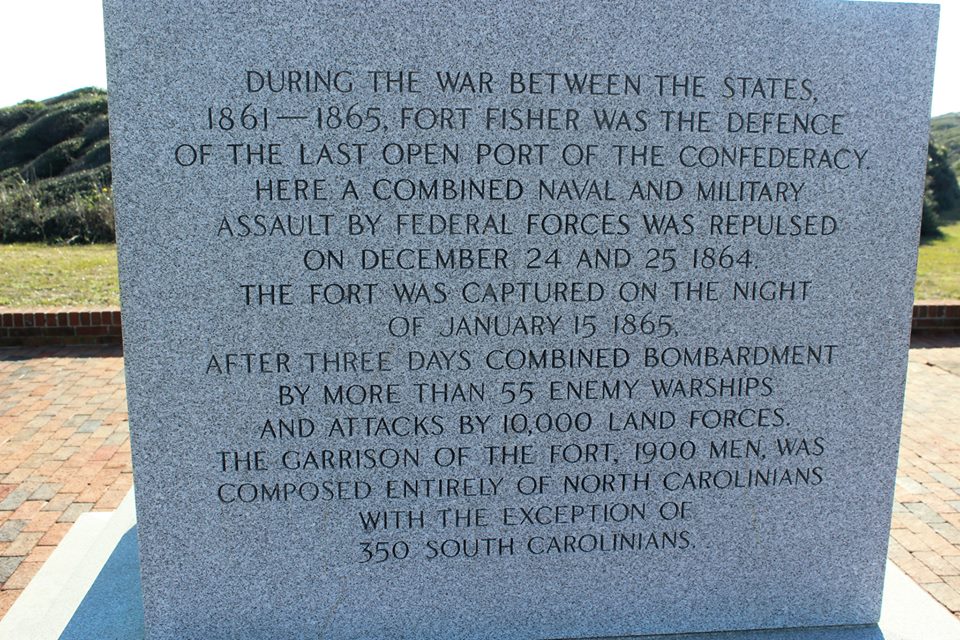
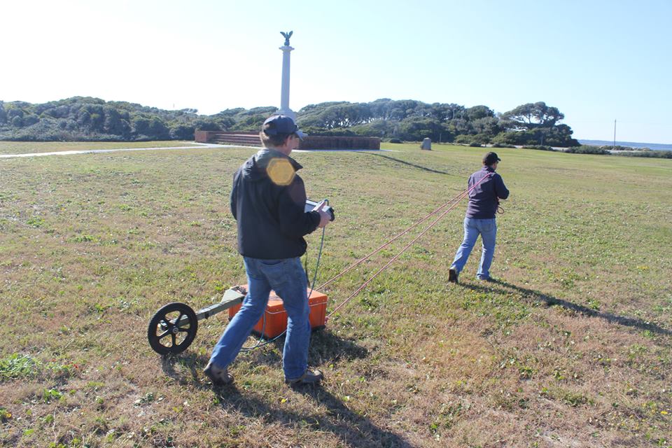
The Department of Geological Sciences is assisting the North Carolina Coastal Heritage at Risk Project by using ground penetrating radar (GPR) to find buried cultural sites and to assess the geological framework which partially controls the vulnerability of a site to erosion processes. A GPR images the subsurface by projecting radio waves into the ground using an antenna (the big orange box in the photographs). These reflect off of subsurface layers or objects where there i…s a change in electrical properties. Reflected energy is received by the antenna and recorded and displayed. Data can be processed to understand the depth scale. Here we are using a 200MHz antenna with a GSSI SIR-3000 system.