Location (Description and Coordinates):
Creswell, North Carolina. Pettigrew State Park Visitor Center: N 35°47’31.37” W 76°24’34.68”
Date Dived/Inspected:
24 May, 2019-26 May, 2019
Weather on date of Inspection (tide, etc.):
24 May, 2019: Clear, little to no wind, 98°F
25 May, 2019: Very clear, no wind, 88°F
26 May, 2019: Moderate, NE winds with .5-1ft waves on lake-surface, 95°F
Depth: 2.5ft at all survey locations (based on boat’s depth gauge).
Visibility/Current:
24 May, 2019: 2ft visibility, no current.
25 May, 2019: 2ft visibility, no current.
26 May, 2019: 2-6in visibility, no current.
Environment (general and biological):
Lake Phelps is a 16,000 acre freshwater lake bordered on the northern shore by Pettigrew State Park. The shorelines are swampy and many cypress trees grow along the waterline explaining the presence of multiple cypress roots in the water. Marine life of Lake Phelps includes Gar, bass, and snapping turtles.
Bottom Composition (sediment description, slope, topography, etc.):
The sediment of Lake Phelps consisted of both a fine silt, mud, peat soil, and sand. Areas of the bottom were more compact while others were softer. Towards the lake shore, the sediment becomes soft and loose silt, interspersed with layers of peat soil and mud. Moving away from the shore, the sediment is a more compacted sand.
Brief Historical Context:
Lake Phelps is a natural lake believed to be 38,000 years old. Of the thirty dug-out canoes found in Lake Phelps (Pettigrew State Park website), one has been radiocarbon dated to 4,400 years ago. Lake Phelps was “discovered” by white residents of the area in 1755. The land around the lake was then purchased by the Lake Company and drained through canals built in the 1780s and 1790s. Pettigrew State Park is named after one of the families who owned land on the northeastern shore of the lake of which one member, James Johnston Pettigrew, was a Confederate General during the American Civil War (Pettigrew State Park website).
Methods of Investigation:
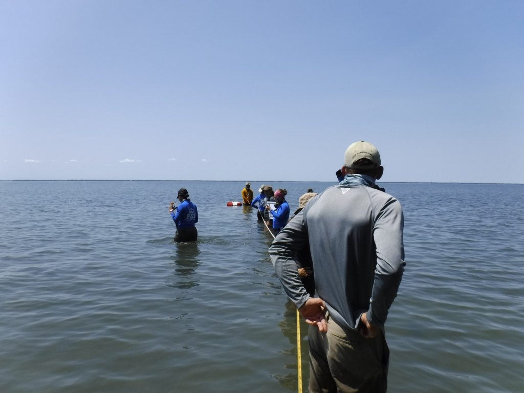
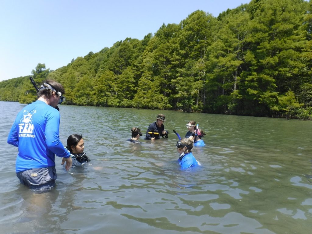
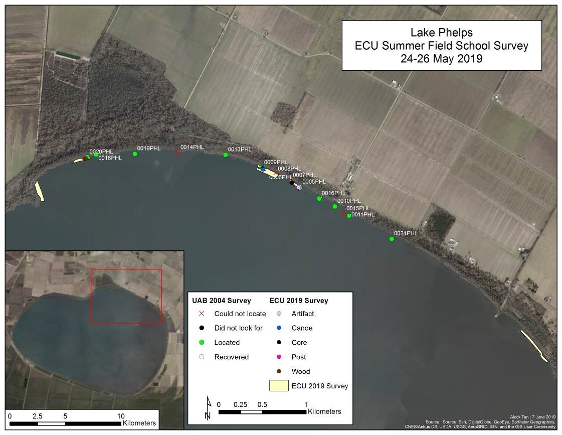
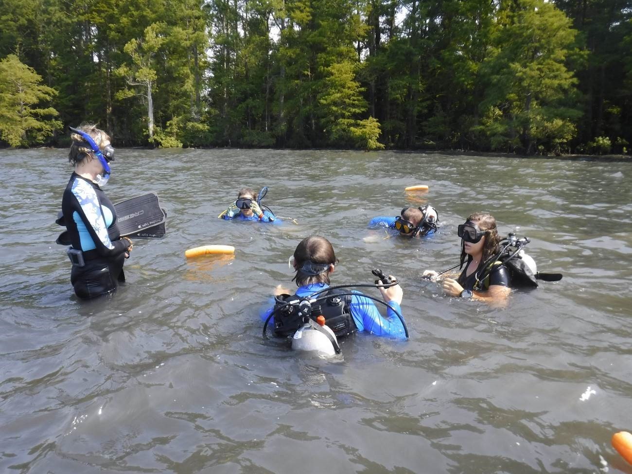
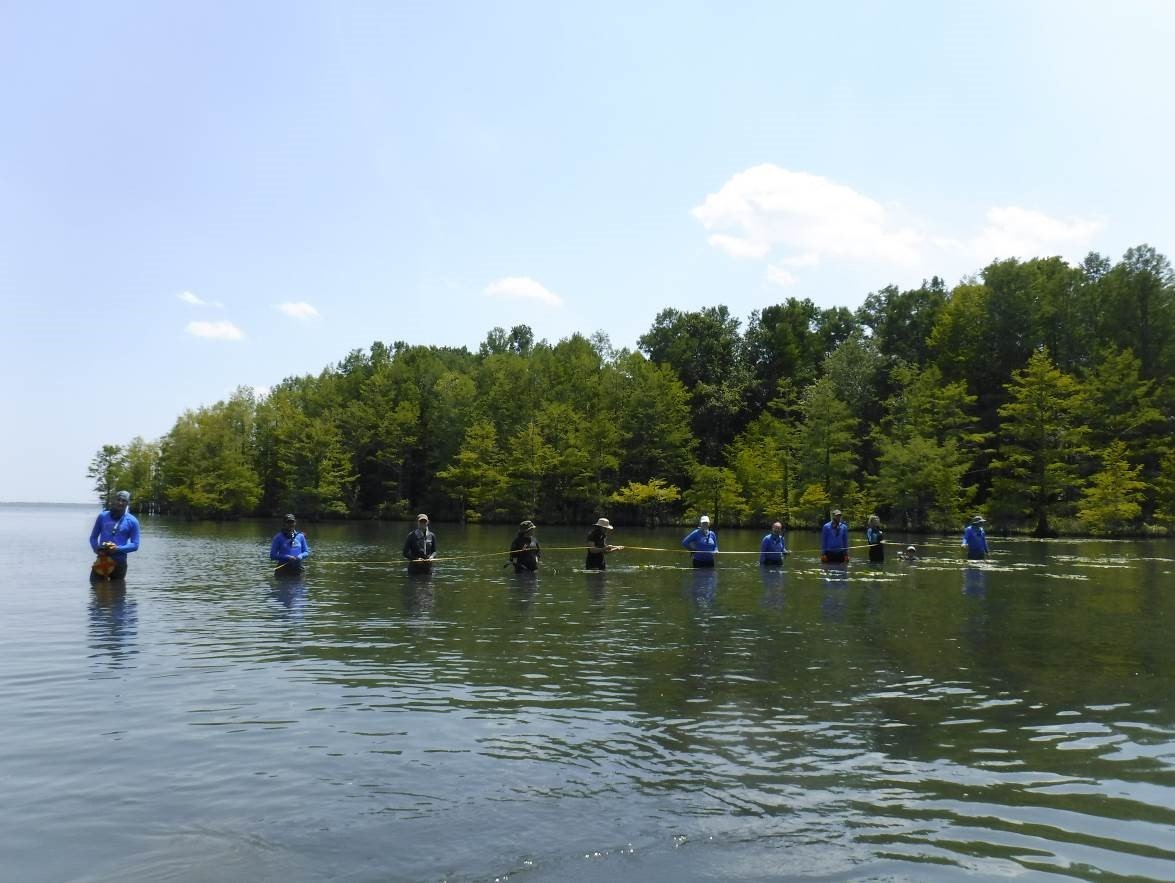
The area of investigation of Lake Phelps was divided into survey areas based on the GPS coordinates determined by the UAB’s 2004 survey. These areas consisted of two or three determined points in order to create a more manageable investigation. Line searches, spanning 20 meters with a team member at every two meters, covered these areas. Potential finds were marked with buoys and then revisited after the conclusion of the line search in the determined area.
On May 24th, the team conducted three line surveys in the above described manner in an effort to rediscover canoes located by UAB. The first survey focused on 0018PHL and 0020PHL on the western portion of the north shore for approximately 200 meters. The second line survey included GPS points for canoes 008PHL and 009PHL on the north shore for approximately 250 meters, and the third survey in the bay area of the western north shore based on the location given by the park rangers. These surveys offered no discoveries of canoes.
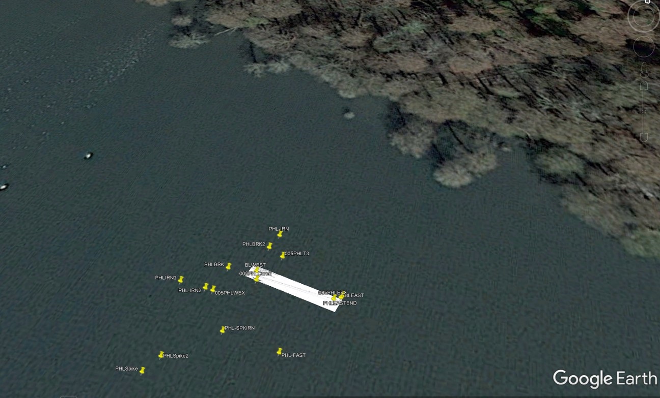
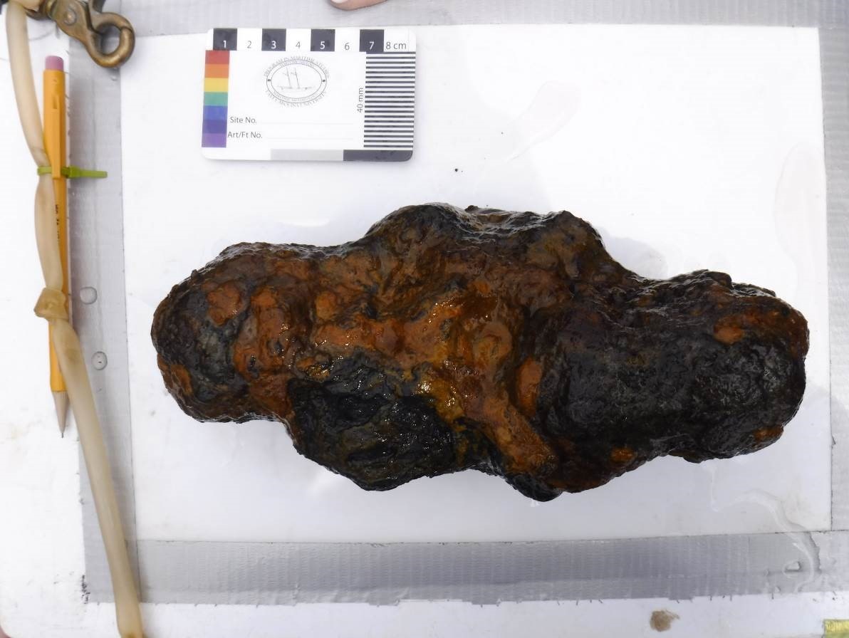
On May 25th, the team continued to conduct line surveys based on the GPS points given by UAB. Again, three surveys were conducted. The first was a survey based on the determined locations of 008PHL and 009PHL closer to the shore. This survey uncovered a possible canoe plank measuring 1.3m This plank is located at N 35°48’7.0” W 76°28’07.1” (labeled 009PHLT1). A core sample (PHLCORE1) was taken at N 35°48’07.3” W 76°28’1.7”. The second survey focused on the determined locations of canoes 007PHL, 006PHL, and 005PHL for approximately 145 meters moving east just 150 meters to the east of the first survey. A potential canoe was marked and located near the UAB coordinates for 005PHL and a GPS point, (N 35°48’1.7” W 76°25’54.0”) was taken as reference for the next day. Around the location of the potential canoe, metal pieces, bricks, and stones noted (pictures of these artifacts below). The third survey intended to survey the UAB location of 0016PHL for approximately 50 meters. However, the wind picked up, as well as the waves and the DSO called off the survey.
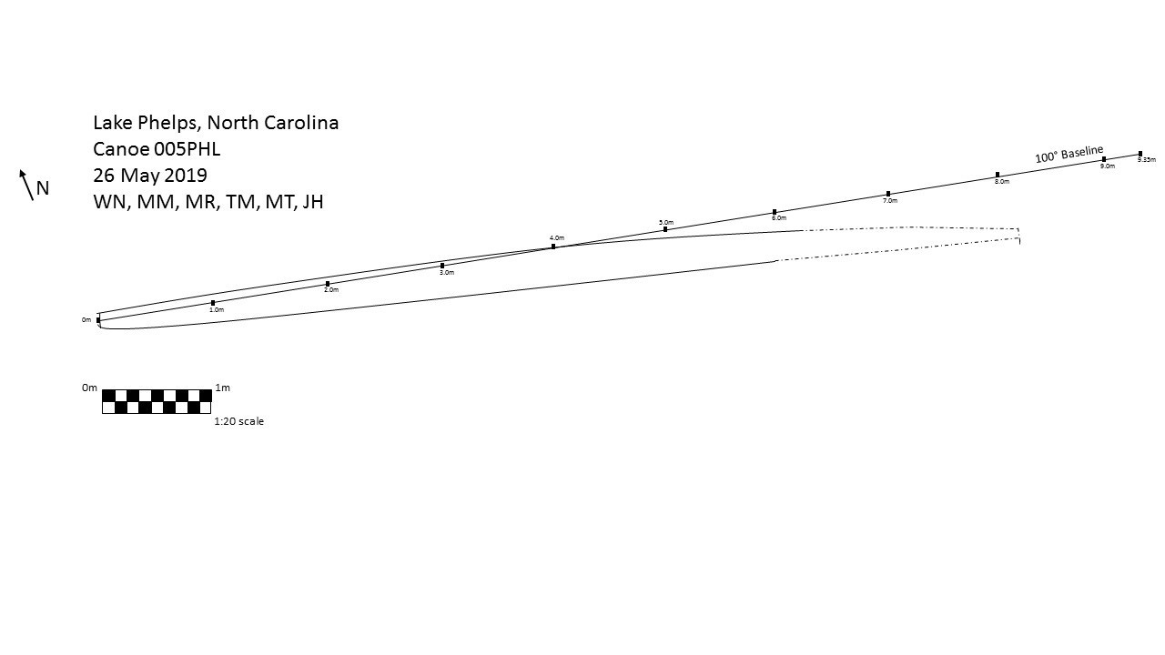
In the morning of May 26th, the team placed a 9.35 meter baseline with a 100° bearing on 005PHL in order to take a series of baseline offset measurements along the canoe. The baseline moved off of the canoe between the 4m and 5m mark caused by the low visibility and thus, difficulty in determining the exact location of canoe 005PHL. Six divers were assigned a 3 meter section of the canoe to take the measurements. The initial goal was to measure the width of the exposed canoe every 20cm. The canoe was determined to be 8.2 meters in length and an average of 25cm-30cm wide.
In the afternoon of May 26th, the team conducted a line survey of 20 meters at the waterfront at Somerset Place for approximately 470 meters traveling west. The purpose of this survey was to locate evidence of a pier mentioned by the Somerset Place tour guide or any other material culture or structures which may have been associated with the plantation.
General Description (of site):
The dug-out canoes located by the North Carolina Underwater Archaeology Branch are all located along the Northeastern shore of Lake Phelps. A last line search was conducted directly south of Somerset Plantation house. The depths at these locations average around only 2.5ft.
Features (Natural and Cultural):
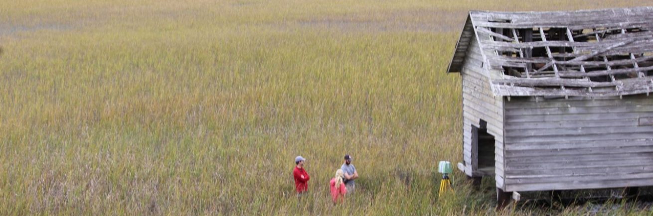
Pettigrew State Park includes the northern shore of Lake Phelps along with the lake itself. The state park maintains a boat ramp and two piers for public swimming and access. Somerset Plantation sits along the northwestern curve of the lake.
Artifacts:
In proximity to the 005PHL, the team found piles of brick and stone and various metal pieces formed in a triangle shape (pictured below).
Human or Environmental Impacts:
The sediment of Lake Phelps is likely to change given the wind and shallowness of the water, constantly covering and uncovering the canoes. The locations of the canoes are easily accessible to the public and thus, human impact on the site is possible.
Potential Threats:
The sediment of Lake Phelps is subject to constant change due to the relatively shallow water leading to the potential uncovering of these canoes. In such a state, the canoes could potentially be disturbed or broken by visitor impact. Additionally, the canoes can potentially move or be buried even deeper in sediment, making it more difficult for researchers to uncover and monitor preservation.
Associated Artifacts Onshore or Nearby (i.e. museums, private collections):
Canoe 003PHL and 004PHL are located in the QAR Lab in Greenville, North Carolina. These canoes were relocated from the visitor center at Pettigrew State Park in order to ensure proper conservation. Other canoe fragments are said to be in the North Carolina Underwater Archaeology Branch’s lab, the Port O’ Plymouth Museum and the Roanoke River Maritime Museum in Plymouth, North Carolina as well as the North Carolina History Museum.
Associated References:
Pettigrew State Park website:
https://www.ncparks.gov/pettigrew-state-park
Curci, Jessica Lee
2006 Logboats of the Southeastern United States: Investigating the Question of Form. Doctoral Dissertation, Department of Coastal Resource Management, East Carolina University, Greenville, NC.
Pierce, Greg
2010 A Synthesis of the Prehistoric Archaeological Investigations of Lake Phelps, Washington County, North Carolina. Master’s Thesis, Department of Anthropology, East Carolina University, Greenville, NC.
Redford, Dorothy Spruill and Michael D’Orso
2000 Somerset Homecoming: Recovering a Lost Heritage. The University of North Carolina Press, Chapel Hill.
Future Research Potential:
The Summer Field School 2019 plans to visit the other sites with potential fragments of the Lake Phelps canoes. These visits have the potential to provide answers to how these canoes arrived in those places and possible paths to take to ensure preservation.
The located canoes could also be analyzed for modification which date post-contact or the colonial time period to more recent. The artifacts found around 005PHL in this field school, indicate the possibility of the canoes’ continued use during and after the colonial period.
Future Public Outreach Potential:
The Lake Phelps canoes could be utilized to educate the public on the Native American maritime culture in eastern North Carolina. The canoes could also be applied to promote public conservation and preservation of historic sites and artifacts.