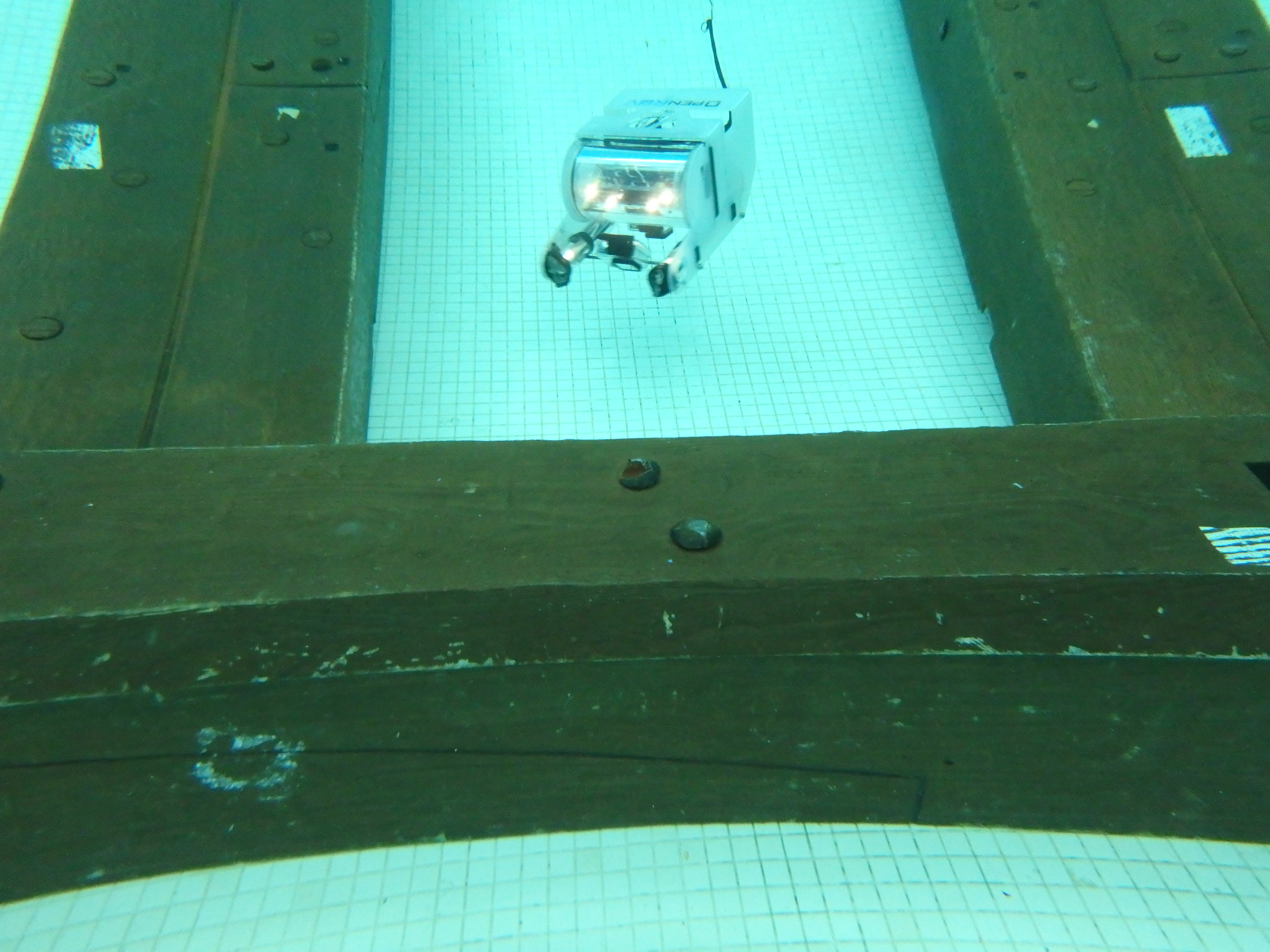
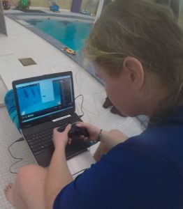
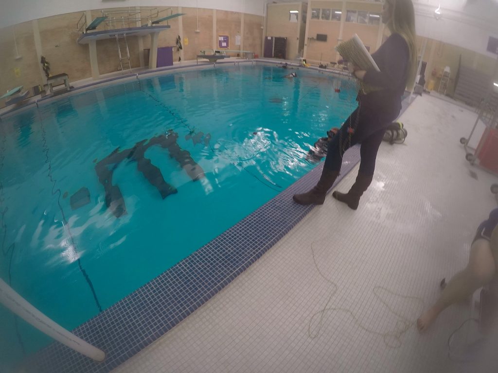
Recently, the Program in Maritime Studies purchased a low-cost OpenROV 2.8. This ROV has been equipped with three GoPros, capable of shooting multiple video resolutions. The customized ROV was successfully used to record and create a 3D model of the schooner Portland, located in NOAA’s Thunder Bay National Marine Sanctuary. If conditions allow, the ROV will be deployed on Lawrence; however, a handcrafted camera mount, capable of holding the three GoPros at the necessary angles, will be used if conditions do not allow for the use of the small ROV.
Photogrammetry and 3D Printing
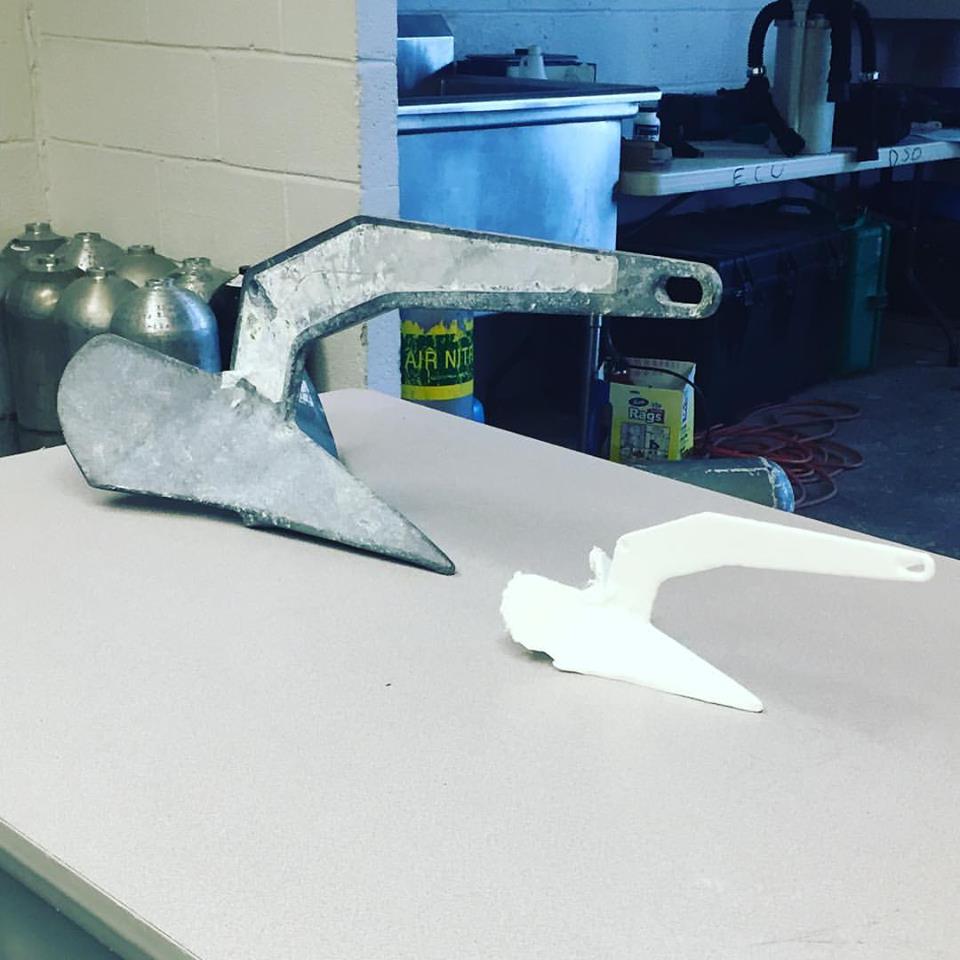
A 3D Printed anchor created by student Annie Wright using underwater photogrammetry.
The use of photogrammetry and 3D printed allows for rapid prototyping and recording of archaeological sites and artifacts. This is particularly useful for sites at risk, as photogrammetry allows archaeologists to quickly record data in great detail. 3D printing allows the public to access sites that may not otherwise be possible, including sites that are too fragile for large numbers of visitor and sites in inaccessible places such as deep or dirty water, or remote locations.
Laser Scanning
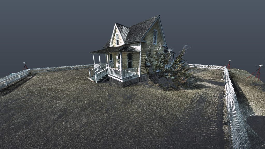
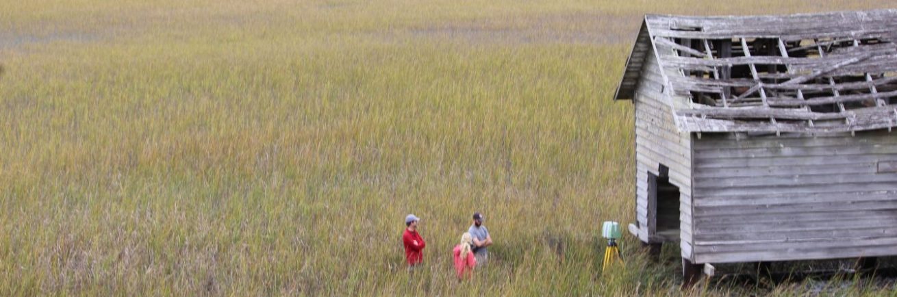
Laser scanning of Henry Piggot Cottage, Portsmouth Island
A Leica P40 terrestrial laser scanner was used to capture a 3D point cloud of the external structure of the Life Saving House, the church, and the Piggot House on Portsmouth Island and the exterior of the Ocracoke Lighthouse. The front façade of the Island Inn on Lighthouse Rd in Ocracoke was also collected with the same technique. Each location was scanned with a point spacing of ~6 mm, although the actual point density is higher given the overlapping point clouds. At each site a common set of reference points (permanent 15.25 cm sphere laser scanning targets) in the field-of-view aided in the registration of multiple point clouds. Point cloud registration was performed in Leica’s Cyclone software. The point clouds were initially registered through a transformation of all point clouds to a 0,0,0m origin in Cartesian coordinates from one scan position and then these were registered to a known (real world) reference within our network of control points. All registered point clouds did not exceed 5 mm of registration error. Data were segmented and cleaned in Leica Cyclone. Visuals were created in AutoDesk.
Ground Penetrating Radar
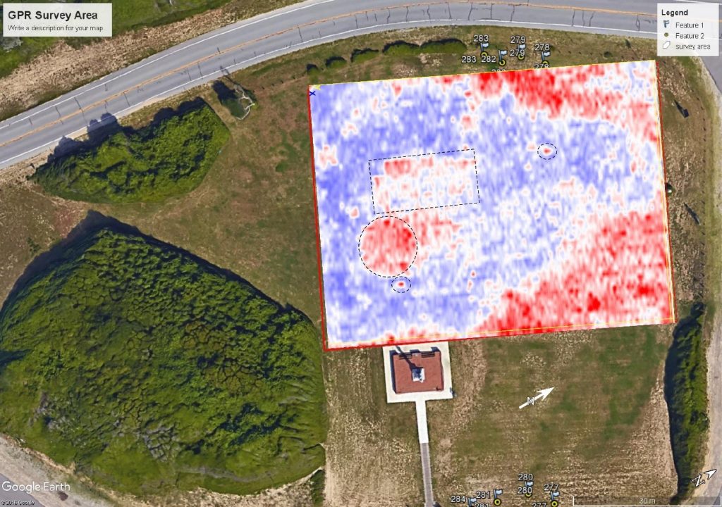
Ground penetrating radar (GPR) was utilized on two separate occasions (Feb. 7 and March 7, 2017). The first survey utilized a GSSI SIR-3000 GPR system with a 200 MHz antenna. The antenna was towed at ~3-5 mph from north to south along Highway 421, through Ft. Fisher State Park, to the Aquarium entrance (Figure 1). Waypoints were marked on the data, and recorded using a Garmin WAAS enabled GPS. Data were processed using Radan v.8 software, and included a time adjustment, background removal, migration, deconvolution, and gain enhancement (Figure 2). The purpose of this first survey was to characterize the subsurface stratigraphic framework and identify the extent of the Pleistocene coquina (which is exposed along the beach), and locate the position of the inlet which was active during the Civil War era. Figure 2 shows the extent of these geological features. The second survey utilized a GSSI SIR-3000 GPR system with a 400 MHz antenna mounted on a push-cart. A survey grid, consisting of 55 NE-SW trending lines (shore parallel) spaced at 1 meter, was flagged and surveyed. Data were processed and gridded using Radan v.8 software (same processing steps as outlined above) to produce a 3D volume to allow for the analysis of depth slices (Figure 3). The purpose of this second survey was to locate any potential culturally significant features. Most notably, it has been proposed that the Civil War era Federal Point Lighthouse and light-keepers cottage were in this area. The map in Figure 3 reveals several potential targets. A circular feature, and an adjacent rectangular distribution of reflections are outlined. In profile these appear to correspond with disturbed and possibly excavated surfaces. Two other small, but very high amplitude reflections are also outlined and correspond to some high density small buried objects.
These data will be further processed to correct for elevation, interpreted in greater detail, and projected in a 3D model in order to relate the modern geomorphology and structures to the underlying geology.