Jekyll Island is the southernmost island of the Golden Isles in Georgia. The island spans 5,500 acres across 10 miles of shoreline with more than 1000 acres of maritime forest. Governor James Oglethorpe named it after Sir Joseph Jekyll (1663 – 19 August 1738) a British barrister, politician and judge with British colonization in 1733. In 1886, the island was purchased by the Jekyll Island Club, a turn-of-the century vacation resort patronized by the nation’s leading families. Club Members included such prominent figures as J.P. Morgan, Joseph Pulitzer, William K. Vanderbilt, Marshall Field, and William Rockefeller. In 1904, Munsey’s Magazine called the Jekyll Island Club “the richest, the most exclusive, the most inaccessible club in the world.” Today, it hosts a variety of vacation homes, a sea turtle nature reserve, thriving restaurants, as well as many other activities along its distant shorelines.
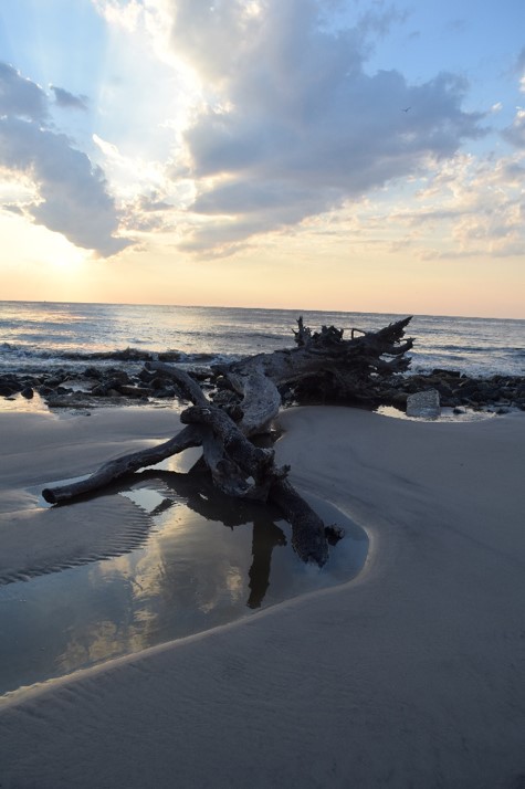
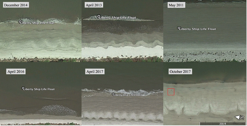
In May 2018 Dr. Kurt Knoerl from Georgia Southern University collaborated with Mr. Bruce Piatek, Director of Historic Resources for Jekyll Island authority, to document and research a boat stranded on Driftwood beach. They determined that it was most likely a WWII Liberty ship life float. In July the ECU team joined them to conduct a rapid site assessment. The site is at risk due to natural factors and beach goers who attempted to remove portions of the hull and fittings using a bladed tool. In addition, the shoreline has changed dramatically since 2011 when the shoreline was much further out at least 31 meters.
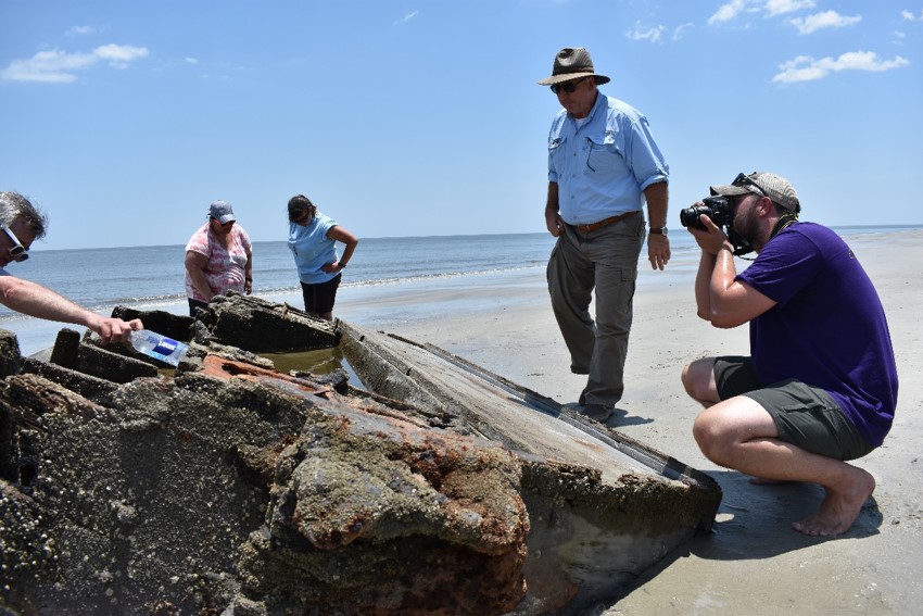
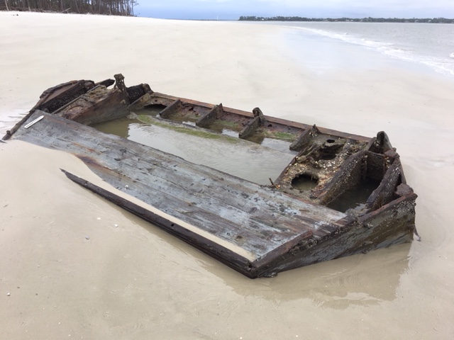
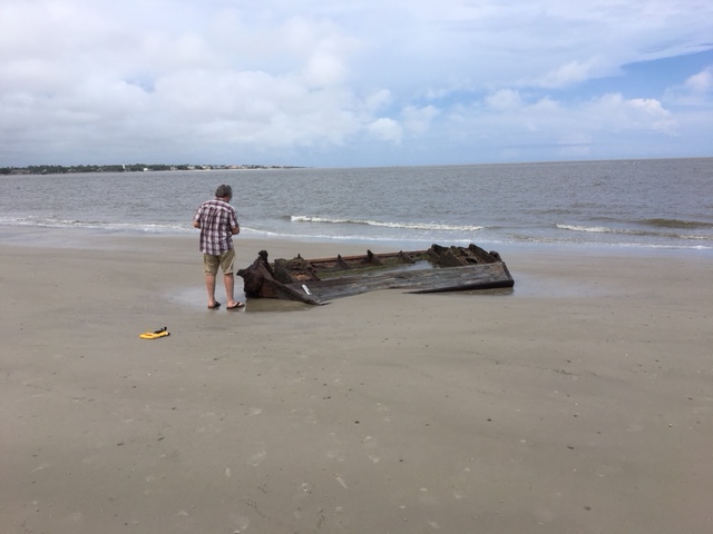
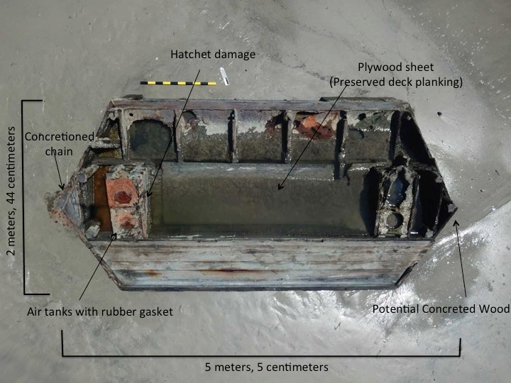
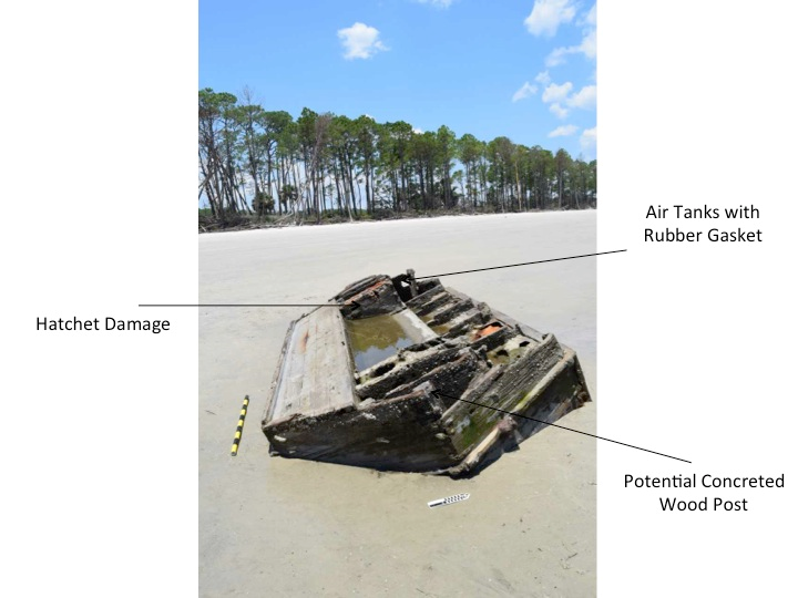
After a short drive along the sandy Driftwood Beach of Jekyll Island, Georgia, we observed piles of driftwood from trees damaged by hurricanes. The life raft float is located on a desolate beach, adjacent to the marsh and mature maritime forest, and completely exposed at low tide. The structure measures 5.50m in length and 4.44cm in width. It appears to be constructed of a variety of woods, some with a red tint while others are likely pine. The outer hull on the northern side has planking missing (believed removed by beach visitors), and underneath the original military grey paint is apparent. Most notably, are pairs of metal air tanks at the front and back of the structure. The “lids” are sealed with rubber gasket. There is evidence of intentional hatchet or machete damage on one exterior of the float. Equally notable, are two large concretions, measuring 38cm high, encrusting the shore-most point of the wreck. This could be possibly be the remnants of a metal chain.
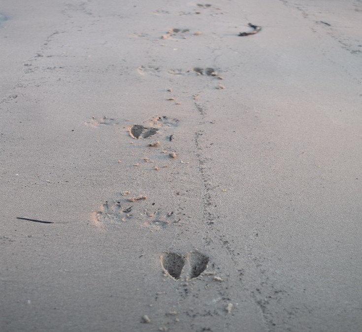
The site also supports local biological life within its structure and surrounds. Crabs, shrimp, barnacles, limpets, algae, and even a small fish all inhabit the life float. It is a living museum and an unusual ecosystem on a beautiful beach! Sea birds utilize the structure and leave droppings. Deer tracks are clearly evident in the vicinity and rattlesnakes are reported in the maritime forests higher up the beach.
Georgia’s barrier islands are part of the Georgia Bight, the longest development of barrier islands in the world including the nearly continuous chain from Cape Hatteras, North Carolina to Cape Canaveral, Florida (Hayes 1979). The Georgia Sea Islands, also popularly known as the Golden Isles, are composed of dune and beach ridges created by a complex interaction between waves, winds, current, and sea level rise. The area consists of low, sandy islands, separated from the mainland by tidal marshes. A majority of these islands are made up of a core of Pleistocene marine terrace rimmed on the outer edges by present sea level beach ridges.
Jekyll Island is a semi-developed, drumstick island, with narrow back barrier areas and dominant regressive mixed-energy beach ridges (Hayes 1979). It is the smallest of Georgia’s barrier islands at 5700 acres. It is located southeast of the city of Brunswick, south of St. Simons Island, and just north of the Florida barrier Cumberland Island. The landward side of the island is edged by Jekyll Creek and an extensive salt marsh (Hunter 2017). Jekyll Island is a magnolia, live-oak forest canopy dominated by palmetto and scrub oak; wildlife includes white-tailed deer, rabbit, squirrel, bald eagle (Hunter 2017).
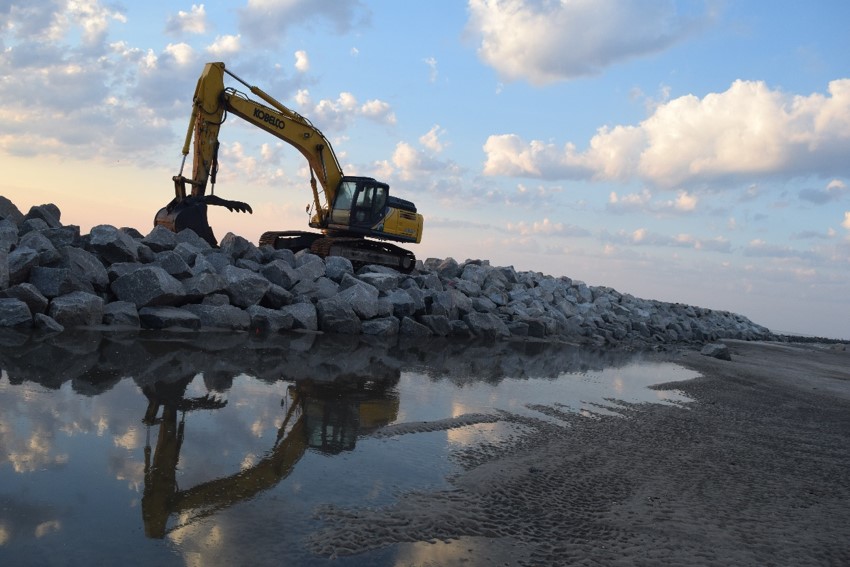
Jekyll Island consists of a core of marine terrace fronted by a rim of modern beach ridges. These ridges have a complex history of accretion and erosion, creating continuously changing island shapes. Typically, the islands are also experiencing southward growth, with northward erosion (USGS 1962). Additionally, severe storms such as Hurricanes Matthew and Irma have created massive loss of elevation. As erosion continues to increase on the north end of the island, there growing concern for beach change management. As such, a rock revetment is being built along the shoreline to combat further erosion.